Magical Odisha – An Architectural and Cultural Odyssey

Odisha located on the eastern seaboard of India has long been known for its rich culture and heritage. Celebrated as Kalinga kingdom in the historical time, Odisha was once an important maritime nation. Odisha’s Sadhavas (merchants) often would make sea voyages to carry out trade with the merchants of Java, Sumatra, Borneo, Siam, Cambodia and Sri Lanka and bring enough wealth. Through these mercantile communities, Odisha also had made profound cultural expansion in Southeast Asia, which is evident among numerous Hindu and Buddhist art of the region. A comparison of Odisha’s historic art with Southeast Asia’s Hindu and Buddhist sculptures show strong cultural ties between the two regions.

IMG_0577

The Golden Sea beach of Puri at the time of Sunrise

IMG_1244

Odisha’s Wall Murals at Nuapatna Village

For an appreciation of Odisha’s heritage and to narrate the stories of Odisha recently Virasat E Hind Foundation had conducted its first curated trip for four guests from the National Museum of Thailand at Bangkok. It was the brainchild of our esteemed friend Ms Anita Bose who also worked as a volunteer in the museum until recently.  Though the guests are based in Bangkok at the moment they represent diverse nationality, Beverly from the United States, Cathy from the UK, Nathalie from France and Tasnee from Thailand.

The trip was for 5 days, part of an 11 day East India Tour, which also included West Bengal, Anita’s home state, apart from Odisha. In Odisha, the trip was conducted in the golden triangle (Bhubaneswar, Puri and Konark), Buddhist excavated sites at Ratnagiri and Udayagiri, the royal heritage of Dhenkanal, Joranda, the global headquarter of Mahima Cult, Dhauli, the battle site of Kalinga, Ragurajpur, Odisha’s craft village, Nuapatna textile cluster and Dokra craft of Saptasajya. The logistic support for the trip was provided by Discovery Tours and Travel, Bhubaneswar.

The trip had been designed to showcase Odisha’s diverse heritage in a capsule, from culture to heritage, forest and mountains, art and craft and food.

Visitors arrived from Kolkata in an early morning flight and they were received with a hearty welcome.

IMG_0235

Receiving the guests at Bhubaneswar Airport

Our first destination was Dhauli, the battle site of Kalinga. Dhauli is also where the story of Odisha begins. At the break of the dawn, the site of Dhauli is transformed into a mystical aura overlooking the Daya River, which was the stage of Kalinga battle. You become a time flyer visualizing how the site would have looked 2,300 years before at the time of the battle and Emperor Ashoka gave up his arms while surrendering to the eight noble paths of Buddhism.

IMG_0262

IMG_0273

IMG_0276

IMG_0281

At Dhauli Battle Site in the Early Morning

Our next stop was the Yogini Temple at Hirapur, one of the four open-air circular shrines dedicated to Tantric Yogini worship in the whole of India. Some of the Yoginis at Hirapur look terrific with their Tantric gesture and attire. Our guests also offered puja at the shrine and were narrated about the Tantric practice in Odisha in the historical era. The temple is dated to 9th century.

After visiting the Yogini temple, we headed for Ranch Restaurant to relish an Indian breakfast. It was also the occasion for a chit chat and to know the interest of the guests better.

IMG_0320

The next stop was at Raghurajpur, Odisha’s craft village. Sri Gangadhar Maharana, Odisha’s finest patachitra artist had been intimated before. Our guests strolled through the open-air art corridor of Raghurajpur and interacted with several artisans and finally spent considerable time at Gangadhar Ji’s house to see his innovations for the art. We also narrated the origin and evolution of patachitra art and what makes it unique among all Odia crafts. Anita also has written a book on Patachitra and Jagannath cult. The next surprise was the Gotipua dance. The young boys had dressed up like girls and performed stunning dance sequences before us for about 30 mins. It was the highlight of the day. Our guests were simply astounded.

IMG_0333

IMG_0344

IMG_0391

IMG_0431

IMG_0500

IMG_0503

At Raghurajpur

We headed for Puri for the check-in at Cocopalm Resort, which is sea facing on the Beach Road.

IMG_0847

IMG_0660

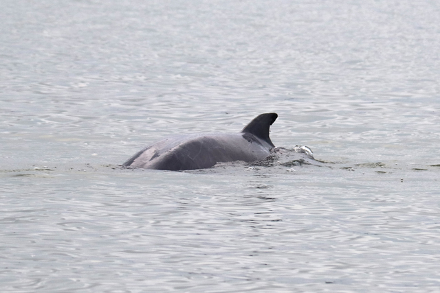
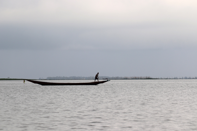
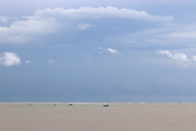
On day 2 the early morning was spent at the golden beach of Puri experiencing various morning activities in the beach and fishermen delving into the deep sea.

IMG_0558

IMG_0561

IMG_0570

At Golden Beach in Puri

After a lavish breakfast in the hotel, we headed for Konark, Odisha’s only world heritage monument and an epic in stone. Our guests were taken on a journey through its art corridors. It was magnificent glowing under the morning sun. After spending an hour we visited the recently built Konark Interpretation Centre and explored Konark’s history, legend, art, architecture and also about history and monuments associated with Sun worship of India. Watching a documentary film on Konark in a cosy theatre was an experience by itself.
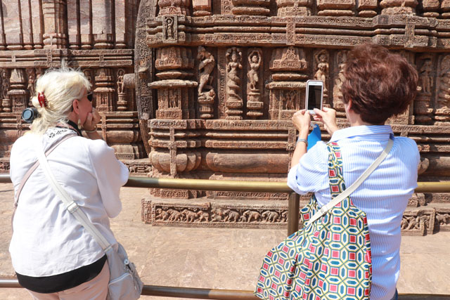
IMG_0678

IMG_0697

IMG_0728

IMG_0759

At Konark

After relishing a delicious meal at the seaside Lotus Resort we returned to Puri for a brief nap. In the evening we again travelled to Konark to witness Odissi Dance at Konark Kala Mandap. Thanks to the gesture of Anita, Abhada, the mahaprasad of Lord Jagannath had been arranged in the hotel.

IMG_0886

On Day 3 we explored the temples of Bhubaneswar in the morning. Our guests were narrated about the idea behind Hindu temples, their meaning and in particular about Kalinga temples, their architectural styles, legends, history and cultural significance. We saw Brahmeswar, Parasurameswar and Mukteswar temples.

IMG_0894

IMG_0907

In Bhubaneswar Temples

After visiting the temples we headed for Odisha Hotel in Lewis Road to relish a sumptuous Odia thali. It was grand with all ingredients of an Odia meal, badi chura, chenna tarkari, kakharu phula bhaja, tomato khata, patra poda machha, and rasagola. All our guests enjoyed the food very much.

IMG_0919

IMG_0920

IMG_0929

After lunch, we went to visit the towering Lingaraj Temple, the highest achievement of Kalinga temples. The next surprise was a visit to the Odisha Craft Museum, one of the finest museums in the country showcasing the region’s finest art and craft heritage.  Our visitors were thrilled while taken through a journey of Odisha’s timeless craft culture.

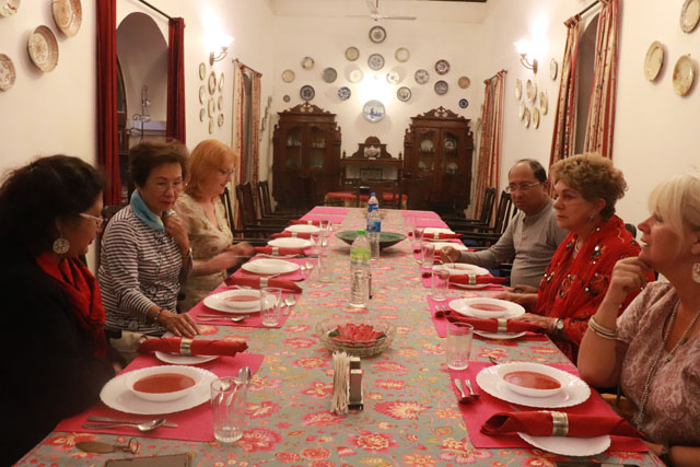
After a coffee break in the museum, we travelled to Dhenkanal for the night stay.

Everyone was surprised when we entered through the ramp and the majestic gate of the royal palace. No one had ever thought that they would get a chance to stay in a royal palace. It turned out to be a wonderful experience for all our guests.

IMG_1145

IMG_1106

IMG_0935

IMG_0960

IMG_0971

Next day was the longest journey to the Buddhist corridor. After breakfast, we headed for Udayagiri and then Ratnagiri, both excavated Buddhist sites having much artistic splendour of Mahayana and Vajrayana Buddhism. It was almost an emotional journey for all our guests specialising in Buddhism and its art.

IMG_0984

IMG_0997

IMG_0999

IMG_1024

IMG_1049

At Udayagiri, Ratnagiri and Joranda

In the evening while returning back we spent an hour at Joranda’s Sunya Temple, the seat of Mahima Cult, a 19th-century religious movement which rejected the Hindu orthodox practises and emphasized on the nirakara (god without form) philosophy. Our guests got a chance to interact with resident monks who are known for their simplicity having matted hair and wearing the bark of trees.

Our last day of the trip was spent at Dhenkanal’s Dokra village and at Nuapatna textile cluster. The highlight of the day was having interaction with Sri Sarat Patra, Nuapatna’s most respectful and talented weaver. The trip ended with the shopping of stoles and saree at his shop.

IMG_1163

IMG_1180

IMG_1198

IMG_1203

IMG_1218

IMG_1221

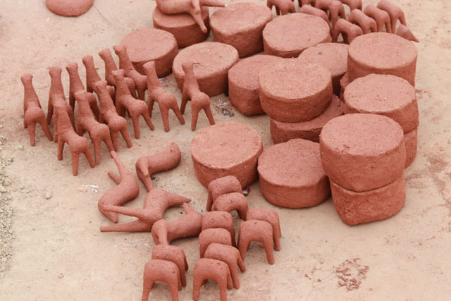
At Dokra Village and Nuapatna with Sri Sarat Patra

In the words of Beverly Frankel

I want to tell you how much I appreciated your knowledge, guidance and friendship throughout our February trip in Odisha’s many architectural and cultural sites. As “Culture Vultures” from the National Museum Volunteers in Bangkok, we adored being able to experience the beautiful villages you showed us for the Patachitra paintings, Odisha dancers, batik and ikat weavers and bronze cast makers.  The religious contrast between the majestic temples of Konark and Bhubeneshwar’s Lingaraj, etc and the Aleka Mahini settlement was amazing to see the range of devotional activities.

Ashok’s conversion to Buddhism retold by murals, stone engravings, and the Buddhist sites of Udaigiri and Ratnagiri were unforgettable. Appreciated especially was our arrangement to spend the night in the old Palace in Dhenkanal.  It was magical –  dining in the garden and living in the spacial splendour of the old rooms. The seaside of Puri and life in the markets and streets of our journey were added delights.

Thank you for making it all possible and guiding us with your vast range of knowledge.


Satpada – Chilika’s finest Magnum Opus

A legend goes: In the distant past, Raktabahu was a pirate king, who had a plan to rob the Jagannath Temple at Puri. He arrived at the coast of Odisha with a huge fleet of ships. Assessing his wicked intention, the seawater moved backwards, making anchoring impossible for the pirate army. Out of anger, Raktabahu attacked the sea, which in turn washed him away with a part of it. That detached part of the sea according to local belief is the Chilika Lake of today.

IMG_9649

IMG_9602

Satpada in the northern part of Chilika is believed to be the place where Raktabahu had arrived. A meeting point of rivers, rivulets, fishing villages and Irrawaddy dolphins at Satpada, nature has created one of its best magnum opuses. Shredded in mysteries, the land has a deep connection with Jagannath Cult.

Also, Read Here:

MANGALAJODI– WHERE ASHOKA IS BORN AND DIES EVERY OTHER DAY

IMG_9393

According to a legend, the daughter of the king of Kanchi was engaged to the Gajapati King of Puri. When the king of Kanchi met the Gajapati, the later was in the act of sweeping in front of chariots of Lord Jagannath, Lord Balabhadra and Devi Subhadra. Considering the act of sweeping offensive of a king the king of Kanchi declined the marriage proposal refusing to marry his daughter to a sweeper.

Gajapati Purusattama Dev felt deeply insulted and decided to rage a war against the Kanchi King. However, he was unsuccessful.

Travel Tips

Satpada is located at a distance of 45 km from Puri in the southern direction and 100 km from Bhubaneswar. There are a few budget staying options at Satpada including the OTDC Yatri Nivas. However for a unique experience tryout Nature Camp at Rajhans Beach. The package includes overnight stay, food, boat pick up and drop from Satpada, nature trek and dolphin sightings. If you don’t want stay, you can hire a 3-hour boat ride from OTDC counter at Satpada for dolphin sightings and a brief halt at Rajhans. While at Satpada, try out the local seafood delicacies, which includes crabs and prawns.


Upon his defeat, the Gajapati King returned to Puri and prayed Lord Jagannath. Moved by his prayer, Jagannath and Balabhadra left their temple at Puri and started an expedition to Kanchi on horseback. Near Satpada, they felt thirsty and chanced upon the milkmaid Manika, who gave them yoghurt to quench their thirst. Instead of paying her dues, Balabhadra gave her a ring telling her to claim her dues from king Purusattama Dev. At Adipur, near Satpada, Manika stopped the king pleading for the unpaid cost of yoghurt. She produced the gold ring as evidence. Considering this a sign of divine support of his campaign, the king enthusiastically led the expedition and defeated the Kanchi King. After the victory, the Gajapati King brought back the princess Padmavati to Puri and married her during next Rath Yatra before the idol of Lord Jagannath.

Also, Read Here:

SOUTH CHILIKA COAST – BACK IN TIME

Satpada today is a traveller’s paradise mainly for the 100 odd endangered Irrawaddy dolphins that are sighted in the tranquil blue water here. Irrawaddy dolphins are a critically endangered species having a bulging forehead and 12 to 19 teeth on each side of both jaws. They are also found in Mekong River and Borneo. In Mekong River, they are regarded as sacred animals by both Khmer and Lao people.

IMG_9454

IMG_9500

IMG_9504

IMG_9508

IMG_9515

IMG_9519

IMG_9526

Dolphins at Satpada are best sighted in the morning before its placid water bed gets crowded by tourists.

IMG_9571

IMG_9536

IMG_9538

IMG_9545

Satpada has plenty of charms for a curious traveller. It is a wonderland for those interested in fishing and discovering the life of fishermen.

IMG_9734

IMG_9719

IMG_9423

IMG_9490

IMG_9374

IMG_9397

IMG_9357

Asia’s largest brackish water lake Chilika has an abundance of crabs, prawns and a variety of fish. Nets and traps are the common gears used for fishing in the brackish lake. While nets are used to harvest fish, traps are used for prawns and crabs. The fishing boats are plank-built flat bottomed ones known as naha.

IMG_0351

IMG_0361

IMG_9370

Among the traps, bamboo traps are most common. An essential accessory to these traps is thette, which is a bamboo screen measuring 40 ft x 4 feet and serves as a pathway for prawns to move in the directions of traps. They are generally set in the lake in the evening and removed in the morning when the catch is taken out. Traps are completely dried before resetting in the evening.

IMG_9784

IMG_9382

Satpada is a timeless romance. A one and half hour boat ride transport you into a noman’s beach amidst the wilderness of the coastal forest and miles and miles of sandy beach. The beach is Rajhans, where time seems to have taken a halt.

IMG_9763

IMG_9779

IMG_9698

The one and half hour boat journey one way is filled with excitement at every turn. You pass by many scenic villages and fishermen engaged in various stages of fishing. Cormorants and Brahminy Kites eyeing for fish sitting on bamboo posts add icing on the cake to your journey. For a moment you become the king of an untamed water territory and your subjects are not humans, but elements of nature, birds and fish.

IMG_9677

IMG_9680

IMG_9693

IMG_9706

IMG_9340

Author – Jitu Mishra

He can be contacted at jitumisra@gmail.com


Talasari Beach – Beyond the Rhythmic Sea

As you approach the Bhogamandapa of Lord Jagannath Temple at Puri, and if you are an ardent lover of art, you are drawn to unique art panels depicting royal processions, scenes of royal assemblies and many more. When you move your eyes to extreme right a panel depicting a royal pleasure boat would draw your attention. The boat is carved along with a crew of rowers and the helm man on the high stern section. The royal figure is seated on a swing and holds a cloth tassel to steady him as the boat progresses. The pavilion has caryatid type pillars and figures cling to the royal umbrella at the prow.

The type of boat shown in the panel is built in clinker technology, a method of boat building that was developed in Northern Europe and was successfully used by the Anglo-Saxons, Frisians, Scandinavians and Hanseatic Cog.

IMG_6543

In clinker technique boats the edges of hull planks overlap each other. Clinker built ships were a trademark of Nordic navigation throughout the middle ages.

IMG_6792

IMG_6793

Today sailing of clinker technique boats has become history in most part of the world. However, in Talasari Beach of North Balasore bordering West Bengal, the millennia-old clinker technique boat tradition has survived along with Sweden, Digha in West Bengal and parts of Bangladesh. Locally known as Patia, these are reverse clinker sailing boats made entirely out of Sal (Shorea robusta) and are heavily coated inbound and outbound with tar. Apart from modifications made to accommodate the engine, all sizes of boats are evidently built in the same manner. The strakes of patia boats are fastened together by nails, which are driven through the overlap and clenched by hooking the emergent point back into planking.

Also, Read Here:

CHANDIPUR – BEYOND THE VANISHING SEA

IMG_6496

IMG_6498

IMG_6501

IMG_6510

IMG_6528

IMG_6530

IMG_6531

IMG_6540

IMG_6539

At Talasari, you are drawn to a romantic flat beach with small and playful waves, a few patia boats, scenes of fishermen repairing nets, red ghost crabs crawling on the golden sand and dense tree foliage.

Travel Tips

Talasari is located near West Bengal Border closer to Digha Beach. The distance between Balasore and Talsari is about 90 km via Jaleswar Town. It is a quaint beach surrounded by small rivers, casuarina forest and charming villages. The Odisha Tourism Panthanivas is the best-staying option at Talasari. The property is located near the river with the best view of the river and beach. The seafood preparation here is simply delicious. Though Talasari can be covered in a day trip however we recommend for a night stay to have the best of experience.

IMG_6563

IMG_6606

IMG_6590

IMG_6583

IMG_6578

IMG_6592

IMG_6593

IMG_6619

IMG_6622

IMG_6639

IMG_6655

IMG_6671

IMG_6727

IMG_6730

Also, Read Here:

DAGARA – ODISHA’S RED CARPET BEACH

The patia boats used by the fishermen are operated in estuaries, beach seining and the open sea. The builders of patia boats are simple folk with no formal background in boat designs. Hence, no drawing, models or moulds (templates) are used when building a patia – measurements are used mainly to ensure symmetry. The boats are largely built ‘by eye’ and much depends upon the experience of the builder.

IMG_6517

IMG_6506

Patias are used in specific seasons of the year. The main season begins from September/October to March/April. The sailing of patia works within about 5 km of the shore, while the motorised may go up to 20 km.

There is no historical record of patia boats, when it came into use in Talasari water, who were its first users, and so on. However, the region around Talasari was a maritime hub from the 16th centuries having active trade contact with European countries, ranging from Danish to British nation. Perhaps it was introduced through contact with Europe.

The only evidence was provided by Thomas Bowrey, a British traveller of the 17th century in Odisha coast. Thomas described the boats as patella – flat bottomed, barge-like clinker-built boats with protruding crossbeams, used to transport salt. They had a single mast and were steered by large median radar.

Talasari is a beach that can refresh your five senses like an instant coffee and heal your body, mind and soul at the first go. Talasari gets its name from Tala (rhythm) and Sari (row) – the rhythm formed by the swing of the lush green foliage and the moving golden sands, both uniting with the calm melodious sea. When it is the low tide you can simply walk across the dry river bed to reach the beach and when it is high tide use the ferry to cross the river.

IMG_6569

IMG_6574

IMG_6598

IMG_6601

IMG_6756

IMG_6767

IMG_6779

IMG_6786

IMG_6808

IMG_6815

IMG_6816

At Talasari you relish the best of seafood at your own pace.

IMG_6850

IMG_6857

IMG_6833

The nearby Chandaneswar is an important business hub in rural Balasore. Bordering Digha Beach in Bengal and Udayapur Beach in Odisha, Chandaneswar is famous for a Shiva temple built in the architectural style of Bengal.

IMG_6885

IMG_6841

IMG_6846

Every year, during the Hindu month of Chaitra (April) a 13-day festival called Chadaka Mela takes place in Chandaneswar. Legend has it that Lord Chandaneswar secretly married Kamini in the absence of his wife Parvati during the month of Chaitra. At the time of Chadaka Mela, devotees in large number get their skin, tongue and body pierced with nails and move around in the procession.

IMG_6887

Chandaneswar also has several women self-help groups engaged in the making of plates and bowls using the local resources, leaves of beetle nut palm trees. You can meet them and by as gift items to spread happiness and sustainable living with nature.

IMG_8524

IMG_8527

Author: Jitu Mishra

He can be contacted at jitumisra@gmail.com

Chandipur – Beyond the Vanishing Sea

You are told and retold…Chandipur in Balasore is a unique beach where the sea recedes for 5 km twice a day during ebb tides.

IMG_7712

During when the sea recedes, the beach turns into a biodiversity hotspot.

IMG_7883

IMG_7668

IMG_7661

IMG_7715

IMG_7659

IMG_7733

Hundreds of ghost red crabs crawl on its golden sands.

IMG_7783

IMG_7893

IMG_7882

IMG_7874

There are swamps covered with thin layers of seagrass sheltering hundreds of tiny fish, gastropods and mollusc species attracting egrets and seagulls for grand feasts.

IMG_7680

IMG_7682

IMG_7679

IMG_7775

IMG_7785

IMG_7713

IMG_7639

Fishermen walk for miles to place wooden posts on the edge of the retreading shoreline only to return next day to bring home kilos of tiny fish that get trapped during the movement of tidal waters.

Also, Read Here:

DAGARA – ODISHA’S RED CARPET BEACH

IMG_7823

IMG_7826

IMG_7832

IMG_7816

IMG_7796

Children play cricket on the dry sand and tourists walk for miles enjoying the unique phenomena of nature.

IMG_7843

IMG_7841

When you go on a leisurely walk in this nature’s Shangri La, you discover hundreds of tiny patterns on sand formed by sea crabs, many having holes. When you approach near them the shy red ghost crabs scurry into these holes.

Also, Read Here:

SAHANA BEACH AND DEVI MOUTH – ODISHA’S BEST KEPT SECRET

IMG_7844

IMG_7846

IMG_7849

You are floored. Chandipur is perhaps the only beach in this part of the world where nature’s drama can be experienced at its best. Your day is made.

Travel Tips

Chandipur is located at a distance of 16 km from Balasore city which is a major railhead and transit point for travel into various parts of northern Odisha. Connected by a metalled road Chandipur can be reached both by public transport and private taxies from Balasore. Though Chandipur can be covered in a day visit however we recommend for a night stay to experience the complete tidal stories of nature and the nearby Balaramgadi Muhana and the maritime heritage of Balasore. The beach has a number of staying options for budget travellers including the property of Odisha Tourism, Panthanivas. Relishing seafood is a major attraction in Chandipur.


IMG_7936

IMG_7960

IMG_7972

IMG_8921

IMG_8922

IMG_8924

However, beyond nature’s hide and seek games, Chandipur has much more surprises. The Budhabalanga River which flows nearby empties into the Bay of Bengal at Balaramgadi, only 3 km from Chandipur in the further north.

IMG_5918

IMG_6309

IMG_6319

IMG_5992

A major fishing harbour today, Balaramgadi at any moment of the day is full of large-sized fishing trawlers and small fishing boats anchored in the jetty. And if you are in the morning hours you find them unloading tons of fish (hilsa, pomp fret, jumbo-sized prawns and many more) from deep-sea fishing for auctions. You also meet subsistence fishermen engaged in various fishing-related activities.

IMG_8075

The Budhabalanga River was a major maritime passage in the 18th century. The Danish, the Dutch, the French and the British used it as a maritime route to seek business and establish factories. In Balasore there are a few vestiges remained of Chandipur’s maritime past. The region was a centre of shipbuilding and ship repairing. Its natives were most resourceful for their knowledge and skills in navigation. So well-known was Balasore in the nautical circle around the world in 1872, a shipbuilding farm in Glasgow was christened ‘Balasore’. In those days Balasore was also a textile manufacturing hub. The muslin handkerchiefs of Balasore had the brand name ‘Balasore Handkerchiefs’. Because of its high quality and uniqueness, an English Man had established a factory in England to manufacture Balasore Handkerchief.

The French also had a tiny colony at Balasore called Loges. The oldest organised maritime service in India was the Bengal Pilot Service which used to lead foreign ships from Balasore to Calcutta through Balaramgadi near Chandipur and vice versa.

Ref: Some Vignettes of Balasore and its French Loge

Today in Balasore there are settlements like Dinamar Dinga, Farasi Dinga and Oladanj Sahi testifying Balasore’s link with Europe’s maritime nations.

IMG_5914

IMG_5947

IMG_5951

Within Barabati High school there are remains of two large Dutch Tombs from the 16th century.

IMG_5884

IMG_5886

There are also remains of a British Cemetery in Damodar locality consisting of 33 gravestones from the 18th century. The graveyard contains the tombstones of Sir Hennery Rickett, the first collector of Balasore (1827 – 36), and his wife Lady Rickett, who was a doctor and had served people with missionary zeal when Odisha was reeling under ‘Nannka Durvikha’, the worst over famine in Odisha that had killed millions of souls due to hunger and diseases. The graveyard also contains the tombstones of Captain Morgante and Captain Francis Walter, a hero of British Royal Navy who led several battles in Madras, Goa, Harispur, Pipli Port and Balasore.

IMG_5927

IMG_5936

IMG_5939

IMG_5942

Chandipur is fairly a meeting point of nature and history and a true representation of Balasore’s cultural identity.

IMG_7891

Author – Jitu Mishra

He can be contacted at jitumisra@gmail.com

Dagara – Odisha’s Red Carpet Beach

As you near the tranquil beach of Dagara after a bumpy drive for almost 20 km from the nearest town of Baliapal, you receive a gracious welcome by nature through a long stretch of red carpet cropping out of the golden sands.

IMG_8820

IMG_8808

IMG_8801

IMG_8799

Little wonder, these little creatures are the fastest runners among all crab species. They are not in hundreds or thousands but crawl in millions. As you approach nearer to them they scurry into their holes. These are ghost red crabs at Dagara Beach in the coastline of Balasore. Their eyestalks allow them to see 360-degree potential predators and prey.

Also, Read Here:

SAHANA BEACH AND DEVI MOUTH – ODISHA’S BEST KEPT SECRET

IMG_8842

IMG_8850

IMG_8854

IMG_8789

IMG_8748

IMG_8716

IMG_8749

Ghost crabs are commonly found on tropical beaches across the world, but there are few places where their concentration is more. They have a little box-like body, thick elongated eyestalks and one claw is longer than the other in both males and females for feeding and digging their burrows. The eyestalks are tipped with horn-like projections called styles.

Also, Read Here:

GOPALPUR – TRANQUILLITY ON THE SEA

IMG_8621

IMG_8758

IMG_8783

Ghost crabs are mainly detritivores but are also active predators and scavengers. They eat algae and animal detritus food among the sand as well as dead fish, insects and marine organism. They leave a large number of sand balls across the beach which they have searched through for food.

Travel Tips 

Dagara Beach is located at a distance of 60 km from Balasore City and 260 km from Bhubaneswar. The nearest town is Baliapal, which is 20 km away. There are a few staying options at Dagara but it is recommended for a comfortable stay at Chandipur or Talsari (both 2 hours away by road). There is also a PWD IB which can be booked through the official procedure. The best time to be at Dagara is when there is low tide, when the ghost red crabs appear in millions on the sandy beach.

IMG_8882

IMG_7915

Dagara Beach near the mouth of Subarnarekha River is one of Odisha’s most unspoiled beaches with a wide expanse of sandy coastline. Fenced by long stretches of casuarina trees it is the only beach in Odisha where one can enjoy both sunrise and sunset. The beach is known for its massive concentration of ghost red crabs.

IMG_8893

IMG_8904

IMG_8906

IMG_8885

IMG_8888

IMG_8682

IMG_8592

IMG_8594

The story of Dagara is incomplete without appreciating the rustic beauty of its surrounding countryside. The Subaranarekha River which originates in the high plateau of Jharkhand in the west was a major thoroughfare in the 16th-17th centuries CE. The Dutch and the Portuguese used this river estuary as the passage to seek their business fortune in the eastern part of India. It is told that the Dutch had established a factory at Baliapal, however, no trace of it can be found. Yet there are vestiges of British East India Company sheds, warehouses, canals and bunds that can be seen as one drive through the countryside.

IMG_8493

IMG_8502

IMG_8510

IMG_8511

IMG_8567

IMG_8577

Yet one more attraction is the countless fishing boats of various sizes and shapes playing in the golden water of Subarnareka and the swamps. And if you are in September – October, the Subaranarekha blooms with vast beds of Kasatandi flowers, symbolizing the arrival of Maa Durga.

IMG_8544

IMG_8536

IMG_8581

IMG_8582

IMG_8588

Author: Jitu Mishra

With Sasanka Rath, Odisha Tourism

He can be contacted at jitumisra@gmail.com

Gopalpur – Tranquillity on the Sea

During the days of the French Revolution! There lived a man called Loraine in France, who always stood for a cause to help the distressed.

The French Monarch did not appreciate his cause and he became a soft target of the authoritarian government. As the French authorities launched a massive manhunt for him, Loraine went into hiding. With the help of one of his close friends, G.G.F Edwardo, a captain in the East India Shipping Company, he arrived at Gopalpur on the coast of South Odisha.

IMG_6654

IMG_6413

IMG_6431

However, for the entrepreneur Loraine, Gopalpur turned out to be a base to seek opportunities for lucrative overseas trade with Burma. He established a port and built the present lighthouse, the star attraction of Gopalpur. Loraine joined his hands with the East India Company and got involved in exporting cheap Bengali labourers, local spices and bidis (country cigars). Within no time he established his own shipping company Bengal India Steam Navigation. Fortune favours the brave. Loraine succeeded in his business building several properties, resorts and hotels at Gopalpur on Sea.

Also, Read Here:

Sahana Beach and Devi Mouth – Odisha’s Best Kept Secret

IMG_6581

Imagine the early 20th century! When Europe was passing through a tough time fighting two world wars, Gopalpur on Sea was celebrating its glorious days.

IMG_6573

IMG_6630

Named after the 18th-century temple of Lord Gopala, the laidback seaside town had its heydays during the period between two world wars. Allured by its strategic location, the British and Loraine’s successors had built massive warehouses and grand villas on the beachfront.

IMG_6583

IMG_6588

IMG_6598

IMG_6586

The prosperity of Gopalpur had brought an Italian merchant from Sicily Signor Maglioni, who had built Palm Beach, India’s first beach resort in 1914. During the glory days of Gopalpur, a large number of rich Bengali families, British traders and soldiers frequented Maglioni’s Hotel. Gopalpur’s character changed over the years from a sleepy fishing village to a prosperous holiday gateway from Calcutta, the cultural heartland of the British Raj, though the capital had moved to imperial Delhi around this time.

Also, Read Here:

South Chilika Coast – Back in Time

IMG_6571

IMG_6593

IMG_6595

IMG_6578

Built-in the Mediterranean architectural style, the Palm Beach Resort, the first of its kind on Indian Shore was a massive hit amused with exotic dines and elegant ball dances. There was gaslight, wooden dance floor and parties that would continue till the early hours.

Travel Tips

Gopalpur on Sea is a small town in Ganjam District of South Odisha. Gopalpur is located at a distance of 16 km from Berhampur, South Odisha’s largest city and a major railway station and 170 km from Bhubaneswar. It takes about 2 and a half hour to reach Gopalpur by road from Bhubaneswar Airport. The other major airport near Gopalpur is Visakhapatnam (4 hours). There are several stay options in Gopalpur to suit all kinds of travellers. However, for a unique experience, we recommend Mayfair Beach Resort and Swosti Palm Beach Resort.  Both are located on the beachfront. Besides Odisha Tourism also has a Panthanivas near the beach. One can easily spend 3 to 4 days at Gopalpur languishing on its beach. From here you can leisurely travel to Ganjam’s other destinations in day trips, such as Taptapani Hotspring, Vetnoi Blackbuck Sanctuary, Chandragiri Tibetan Monasteries, Taratarni Temple and Potagada Fort.


IMG_6579

IMG_6568

IMG_6484

IMG_6629

Many Christian missionaries set up training schools and seminaries, some of them still exist today.

Gopalpur’s prosperity started declining after the end of World War II. After India became independent, most of its wealth dwindled to tickle as the British left the Indian shore. The busy waft crashed down and the sprawling warehouses crumbled.

IMG_6561

IMG_6563

IMG_6565

IMG_6575

Rai Bahadur M.S, Oberoi, one of India’s first generation luxury hoteliers purchased Palm Beach from Maglioni in 1947 at a throwaway price. The hotel got a new identity ‘The Oberoi Palm Beach’. In 2013, the hotel was further bought by the Mayfair Group and now has evolved as the best luxury hotel in this sleepy fishing town.

Today, Gopalpur on Sea has again evolved a perfect gateway for laidback holiday seekers. Its long stretch of languorous beach with coconut groves, casuarinas and gentle sand dunes is deserted for miles. For hours after hours, Gopalpur is the place where you can stroll on the sand and relish on mouth-watering seafood. Watching the life of Nolia fisherman is also exciting.

IMG_6459

IMG_6460

IMG_6462

IMG_6468

IMG_6483

IMG_6607

IMG_6633

IMG_6637

IMG_6641

IMG_6649

IMG_6650

IMG_6654

IMG_6663

A little away from Gopalpur is the enchanting countryside of Ganjam. Cycling around here will simply drag your soul into an experience of a lifetime. You are drawn to the age-old practices of fishing and farming and the fishermen navigating the narrow channels of creeks.

IMG_6672

IMG_6675

IMG_6682

IMG_6684

Barely 16 km away from Berhampur, South Odisha’s commercial hub, Gopalpur is truly a tranquillity by the sea.

Author: Jitu Mishra

He can be contacted at jitumisra@gmail.com

Olive Ridley Sea Turtle in Bhubaneswar’s Walls – A Visual Treat

Olive Ridley Sea Turtle is the smallest and most abundant among all sea turtles found in the tropical world. They are found mostly in warm and tropical water, primarily in the Pacific and the Indian Ocean.

Growing to about 2 feet in length and weighing around 35 kilos, Olive Ridley Turtle is best known for their behaviour of synchronized nesting in mass number, termed arribadas. Females return to the same beach from where they hatched to lay their eggs. They lay their eggs in conical nests about one and a half feet deep, which they laboriously dig with their hind flippers. Gahiramatha and Rusikulya Estuaries are the world’s largest mass nesting sites for olive turtles.

Mating often occurs in the vicinity of nesting beaches, but copulating pairs have been reported over 1000 km from the nesting beaches.

Olive Ridley Sea Turtles migrate in large numbers from the beginning of November every year for mating and nesting on the coast of Odisha. Within two months the nesting season starts.

However, though listed as vulnerable under IUCN and protected under the ‘Migratory Species Conservation’ there is a high rate of their mortality due to collision with boats, trawlers, gillnets ghost nets and longline fishing. In addition, coastal development, natural disasters, climate change and beach erosion have also become potential threats to nesting grounds.

img_0567

The carcass of an Olive Ridley Turtle found near Devi River Mouth

Also, Read Here: 

The Slow Death of Odisha’s Living Marine Heritage; the Olive Ridley Turtles

There is also a lack of public awareness about Olive Ridley Turtles in Odisha. Both as ideas of beautification and generating awareness recently part of Bhubaneswar’s public walls were illustrated with cycles of their migration and nesting on Odisha coast.

02

The drive for beautification started in October 2018 with an eye on Odisha Hockey World Cup that was held in Bhubaneswar in the following months. The artwork was carried out by 15 groups of artists from Odisha Modern Art Gallery, Krutika, Konark Arts, Bakul Foundation and Sutra Advertising apart from several individual artists. Each of the groups had submitted proposals on themes focusing on wildlife, folk and urban lifestyles, hockey and tangible and intangible heritage of Odisha in general and Bhubaneswar in particular.

Travel Tips: 

Bhubaneswar’s AG Square where murals are drawn is located at the heart of the city, at a distance of 2 km from the Airport and the Railway Station. Go in the early morning to avoid traffic. For Olive Ridley Turtle sighting the best place is however Ruikulya Estuary, 150 km from Bhubaneswar towards south on Berhampur Highway. February and March are the nesting seasons.

The AG Square area, which forms the city’s most prime location, was chosen for Olive Ridley Turtle and the work was assigned to artist Satyabrata.

03

Olive Ridley Turtle (Oly) was also the official mascot for Odisha Hockey World Cup 2018. One section of the walls focused on Oly as hockey players.

01

Today any passerby on the roads around AG Square is drawn for a moment to these beautiful murals and for children no doubt these together have become an open-air picture book to explore the world of Olive Ridley Turtle.

Author – Jitu Mishra

He can be contacted at jitumisra@gmail.com

Charu Maa – The Face of Durga Maa

Our story starts in the 7th century CE Bhubaneswar! It was the time in Indian history when the personification of ideas came to be institutionalized.  One such idea was Nataraj, the cosmic dance of Lord Shiva, which you find profusely in temple walls of Bhubaneswar. Why Nataraj – for me the answer could be the metaphoric representation of destruction that depicts the other side of the sea which is otherwise gentle and calm through most of the year.  The other idea was Maa Durga – the metaphoric representation of women power, for which Eastern India is widely celebrated.


Goddess Durga in Parasurameswara Temple – 7th Century CE

Lord Nataraj in Parasumeswara Temple 7th Century CE

Maa Durga in Cuttack 

1999 super cyclone that had devastated millions of lives, both humans and domestic animals in coastal Odisha. Lord Shiva had shown his extreme form, tandav leela. It was one of the darkest moments in Odisha’s modern history. It took years to recover what Odisha had lost. But the lesson learnt not only made Odias cautious but Odisha became a successful model for disaster management worldwide.  Much has been written and filmed about Odisha’s adorable initiatives in cyclone management, but very little about Charu Maa, a woman in her 50s from Gudalaba Village near Astarang on the coast of Bay of Bengal. You see the face of Durga Maa in her, who has been leading a group of 90 women from her village consisting of both Hindus and Muslims for the protection of forest and wildlife from the time their village was devastated in the wrath of 1999 cyclone.

Travel Tips

Gundalba Village is located in Astarang Block of Puri District at a distance of 10 km from Astarang. On your way to Gundalaba Village, you can also visit Pir Jahania Beach and the revered Sufi shrine and trek through the dense Casuarina Forest. Remember, there is no public transport facility here. You have to arrange your own vehicle to reach here. Gundalba is located at a distance of 70 km from Bhubaneswar and 55 km from Puri. The world heritage site of Konark is only 30 km away. 

There is no stay option here. But with prior information and local contact accommodation for a night stay can be arranged at Forest Rest House. There are also plan for tented accommodation in the near future by Ecotourism Wing of Odisha Tourism. With prior information, food can be arranged at the sight with the speciality of seafood. 


Charu Maa in the left at Gundalba Village


Gudalaba is a small village of farmers and fisherfolk near the Sufi shrine of Pir Jahania at a stone throw distance from the sea. A thick forest of Casuarinas separates the sea from the village. To the north of the village is a network of creeks of Devi River which meets the Bay of Bengal at Sahana. Nature’s paradise, the beach is also part of the rookery of Olive Ridley Turtles.  The casuarinas trees, a native of Australia had been introduced more than a century ago by the British to prevent sea erosion. However, ecologists have a different viewpoint. According to whom, the alien trees have been least protectors from sea erosion. These have only become a good source of fuel. On the other hand once dominated by hundreds of species of native mangroves, now most of it lost, thanks to intensive shrimp farming and agriculture. The loss of mangroves is taking toll of destruction year after year.  

Also, Read Here:

Sahana Beach and Devi Mouth – Odisha’s Best Kept Secret


Pir Jahanaia Sufi Shrine


Pir Jahania Beach


An abandoned boat at Pir Jahania Beach


An abandoned house at Pir Jahania Beach – Behind it the thick Casuarina Forest


Casuarina Forest


Depleting Mangrove Forests and Estuaries 


Near Devi Mouth


Commercial Fishing in Devi Mouth


Subsistence Fishing in Devi Mouth 


Intensive Rice Farming – The Harvesting Season


Harvest of Gold

Gudalaba has also been a nurturing ground for ideas related to wildlife conservation and sustainable living. Here you meet Bichhi, the turtle man, who has dedicated his life for the conservation of Ridley Olive Turtles. You also meet a group of youngsters led by Soumya Ranjan Biswal, who are continuously engaged in generating awareness on beach cleaning and environmental protection.


Conservation of Olive Ridley Turtle – a severe environmental issue – This one is one of the first deaths sighted this season due to trawlers movement


It was on 4th November night I was first introduced to Charu Maa at her residence and while talking to her I felt the best geography teacher I have ever met in my life. There is so much of understanding about sustainable living that we have taken for granted as dwellers of large cities. I heard the first-hand experience coping the most severe disaster in the living memory of Odisha. I saw the face of Durga Maa in Charu Maa. It was decided to film her interview on the daylight the next day along with her other women companions.


An early morning scene at Devi Mouth 

Here is what she narrates:

Charu Maa has turned crises into opportunities and it is an eye-opener for each of us. Truly she celebrates the idea of Durga Maa.      

Author – Jitu Mishra

He can be contacted at jitumisra@gmail.com

Mandapeshwar Caves – Isolated Remains Of A Tumultuous Past

4 kms in an hour. My bike can go faster but not the rush hour traffic and crowd of Swami Vivekanand Road in Borivali. Does not matter if its a sunday today for in Mumbai every waking hour is a rush hour. Exhausted but finally in front of Mandapeshwar caves. How I wish I could go back in time when the Buddhist monks used the Dahisar river to travel between Kanheri- a 5th century Buddhist university and Mandapeshwar- a Hindu rock cut cave complex that the monks had made their home.

Centuries have gone by and a lot has changed, including the course of Dahisar river that now flows at least 300 meters away to the east of the caves and is reduced to a dirty nullah. A far cry from a navigable river that was a nodal point of a wider trade route.

facade of Mandapeshwar cave

Nevertheless, I was very happy to see the caves being preserved and protected well with a compound wall and a large open breathing space in front of the caves contrary to Jogeshwari, Magathane and other such rock cut caves that are choked by illegal urban settlements mushrooming all around them.

Mandapeshwar is rather small for a cave complex and has just two caves, one much smaller than the other. The bigger cave, as is apparent was meant to be the main shrine for Lord Shiva while the other one- which is largely unfinished, plain and devoid of any sculptural traces was meant to be the living quarters.

Front pillars cave 1

The caves start capturing your imagination from the entrance itself where four completely worn out frontal pillars of the Mandapa flanked by two pilaster in a fairly good state at the extreme ends, greet you.

claws of an animal appearing like lions at the entrance of cave number 1

There are evidences of claws of an animal- most probably lion on both the sides of the entrance steps. As one enters the mandapa, we see more refined and fairly intact pillars. This cave has a total of five cells of which two are at the extreme ends and facing each other while the middle three cells are along the rear wall. It has a large Mandapa spread across five cells, most likely the reason why this cave shrine came to be known as Mandapeshwar- hall (Mandapa) of the lord (eeshwar).

L to R (nataraja cell, Pashupata cell, Sanctum, another cell, and the cell from where i have clicked this picture- a total of 5 cells)

cave interior

Entrance to the sanctum cell in cave 1


The central of the five cells is the sanctum sanctorum of the cave- the abode of lord Shiva. The entrance to the sanctum is flanked on both the sides with pilasters. These pillasters are designed in almost the same way as the rest of the pillars in this cave are, with an Amalaka as a capital. A quintessential feature of many rock cut caves of this period that are dedicated to lord Shiva, be it Mandapeshwar, Elephanta or as far as Badami in Karnataka.

Newly installed lingas in sanctum


a sculpture in one of the niches in sanctum of cave 1

The interior of the central shrine is largely plain except for a couple of niches carved in the walls housing remains of withered sculptures. The sanctum is occupied by two Shiva lingas that are clearly a later addition to the cave.

Nandis in front of sanctum

Just outside the entrance of the sanctum, sits the original sculpture of Nandi bull- the vahana (vehicle) of lord Shiva, split into half with just the rear half still in place. Alongside the old and injured Nandi sits a younger Nandi with his ears in place to listen to the devotees. It is a general custom to whisper one’s wishes in the ear of the Nandi so that it reaches Lord Shiva and the same is granted. Look out for the inscription on the door jamb –  done during the Maratha rule as is evident from the devanagari script

Inscriptions on door jamb of sanctum

Moving to the extreme left cell, we see what can be termed as a treasure – a Nataraja panel carved with great details. A massive six armed figure of Nataraja takes the centre stage here surrounded by various other figures. On the right are the figures of Goddess Parvati along with two of her attendants. While on the other side is an artist beating a drum. The upper left corner is occupied by the three headed Brahma while the upper right corner has Vishnu. Just below Brahma’s sculpture is the sculpture of Lord Ganesh. Celestial beings are present on both the sides of the head of Nataraja.  The panel seems like some sort of a celebration, Henry Salt in his ‘Account of the caves in Salsette’ published in Transaction of literary society in Bombay Vol.1 1819 A.D, describes this panel as that of Shiva’s marriage with Parvati. However few historians are of the opinion that the figure thought to be Parvati is just another attendant and the panel depicts the dance of Nataraja to the beats of a drum!

Nataraja panel cave 1

The story of the creation of Mandapeshwar caves between 5th and 6th centuries and the ensuing events that took place is a tale of how structures bear a testimony of the struggles of the time and encapsulate it. 90 percent of the rock cut caves in Maharashtra are of Buddhist origin including the nearby caves of Mahakali & Kanheri, but what makes Mandapeshwar fascinating is that the construction of this Shaiva cave is also attributed to the Buddhist monks. What made the Buddhist ‘missionaries’ hewn a Hindu cave? Could it be that Buddhism- a comparatively new religion then considered itself to be a faction of Hinduism? Is it possible that the Buddha was still considered more of a saint than God while the Hindu Gods continued to be worshipped?

Lets compare the time periods of the construction of Kanheri and Mandapeshwar caves. Kanheri caves, cut as early as 3rd century BCE, attained the status of a Buddhist university between 4th and 5th centuries. At its zenith, Kanheri had a total of more than 125 different types of caves and structures including Stupas, cemeteries, Chaityas (prayer halls) and Viharas (residential chambers for monks) carved out of a single rock hill. There is a possibility that during those years Kanheri’s infrastructure could not handle the increasing population and they were forced to look for accommodation options for its visiting monks. Various historical texts confirm that Mandapeshwar was indeed used as a residential quarter by the Buddhist monks. Kanheri was situated very close to the mouth of Dahisar river and Mandapeshwar was along its banks making it very easy for the monks to access it by the riverine route. Dahisar river was a part of a bigger trade route that existed between Konkan and Sopara (today’s Nala Sopara which was an established Buddhist center back then).

Pashupata panel cave 1


Another sculptural link that connects the dots, is the cell between the sanctum and the Nataraja panel cell. This cell is apparently thought to have had a large sculpture of Lakulisha (a Shaiva sect reformist and often considered the last avatar of lord Shiva himself) in the centre sitting on a lotus flower, stem of which is held by two nagas, while the central nonexistent sculpture is surrounded by other divinities and celestial beings. The style in which the lotus is carved, anyone with even a little knowledge about Buddhist sculptural art would not miss the connection between this sculpture and sculptures of Buddha represented in rock-cut art of the same period. Although, much is lost in this panel and the central Lakulisha figure is destroyed beyond recognition, we can only guess (logically) that the Pashupata cult that Lakulisha is often associated with, was dominant during this period.

Plain interior of cell next to Sanctum (if Pashupata cell is on left then this is on sanctum's right side)

Looking out from Pashupata cell

The cell on the other side of the sanctum however is plain with no sculptures except for few on the pillars and so is the lateral cell next to it

Cell 5 (its not called cell 5 .. im calling it cell 5 so you know which one is in the picture)

Sculpture on a pillar in cave 1

As you step outside the main cave and walk towards the second cave, you notice a misplaced symbol on the southern facade- a rock-cut Christian cross. This seemingly small cross however is the only remnant of Mandapeshwar’s tumultuous past. The Portuguese chipped off what was thought to be an idol of lord Shiva and flattened it to carve a cross out of it.

Southern external facade of the cave (right side is the Portuguese cross, and left side is the entrance to Cave 2)

Every event that soon followed has two drastically opposite theories, one from the Hindus trying to portray the Portuguese and the Christians in bad light and the other claimed by the Portuguese blaming Marathas for destruction of sculptural art here due to the usage of heavy explosives to uncover the Hindu sculptures from the plaster used by Portuguese to hide them.

Clicked from cave 2

It all goes back to the time when the Portuguese were ruling Mumbai with their main base in today’s Thane on extreme northern end of Sashti- the Marathi name for Salsette island on which the caves are located. Hearing about these wonderful rock cut caves, the Portuguese arrived here in mid- 16th century and chased away the Hindu yogis to set up their base in Mandapeshwar thinking of a larger role for it to be played in future. The Christian account of the same story however claims that the Portuguese arrived at Mandapeshwar wanting to meet the Hindu yogis but hearing of the news of arrival of the Portuguese, the Yogis got scared and ran away. However, both these accounts agree that a yogi known as Ratemnar was converted by the Portuguese priests and was given the village of Mandapeshwar.

Cave 2 & cave 1 and monastery on top of it


The Caves were soon converted into a shrine for Mary named as Nossa Sra De Piedade (roughly translating to Our Lady of Pity) with all its Hindu sculptures buried under a thick layer of smooth plaster and the Shiva shrine was hidden by a brick wall in front of it. Mandapeshwar was ripped off its identity and it came to be known as ‘Monapazer’ or ‘Mont Pesier’ by the Portuguese. As a part of expansion of the complex, a church and a monastery was constructed on top of the cave and was used to impart religious education to the recent converts and other Indian Christians. Another shrine was erected on the opposite hill and a graveyard in between the two.


Mount Poinsur church Graveyard

After about 180 years of functioning as a Christian shrine, Mandapeshwar returned to its original ‘faith’ and again became a Shaiva shrine when Maratha prime minister Bajirao Peshwa 1 defeated the Portuguese in 1737 in the battle of Bassein (Vasai). But Mandapeshwar soon exchanged hands when the Sashti island went to the British in 1774 under the treaty of Salbai with the Marathas. The caves again became a Christian place of worship. The Portuguese church, however couldn’t survive and what remains today are beautiful ruins evocative of a distant past. 

Ruins of the Portuguese monastery Pic 2

Ruins of the portuguese monastery

The second cave at Mandapeshwar is very different than the main cave in many ways. There are no sculptures, no carved pillars, no idols, no niches but just a large plain hall. The only traces of carvings are found on the entrance pillars which form the southern facade of the main cave.

Narrow rock cut path to cave 2

Cave 2

Cave 2 interior shot

Mandapeshwar caves remained a Christian place of worship till 1920’s and was possibly abandoned later. Around 1960’s the caves were declared a protected monument by the Archeological Survey of India and continues to be a popular Shaiva shrine. Life seems to have truly come a full circle for Mandapeshwar!

a small devotee

A walk today in this area better known as ‘Mount Poinsur’ (a disambiguation of Mandapeshwar) of Borivali is a living reminder of its past. The residential area along the Laxman Mhatre Road and Swami Vivekananda Road are largely Hindu whereas to the rear side of the caves is IC colony; named after the Portuguese Immaculate Conception Church, a residential colony that has highest concentration of Christians in entire Mumbai. As a popular quote by journalist Edurado Galeano goes “History never really says good bye. History says, see you later”!

Author – Onkar Tendulkar 

He can be contacted at onkaar7@gmail.com      

South Chilika Coast – Back in Time

It was a sultry September night of 1996 and I was camping in a government dak bungalow in a small town, Huma in Odisha’s Ganjam District. I, along with my mentor Prof K.K. Basa, was surveying the southern coast of Chilika Lake in a village called Gaurangapatna. That night, a ceramic piece depicting a boat motif crunched beneath my feet. A major archaeological find indeed but it was just a dream. In the morning when I revealed this to Dr Basa, he laughed and dismissed my dream. But my heart was onto it and waiting for a miracle. Around 4.30 pm the same afternoon, I happened to pick up a ceramic piece with a stamped boat motif, from a field on the foothills of Ghantasila. I was thrilled and so was Dr Basa. It provided tantalizing evidence of what may have been fishing or a shipbuilding guild of early medieval India. Immediately we dug a trial trench to test the site’s potential. Our discovery of turquoise blue glazed pottery from the Persian Gulf dated approximately between 8th-10th centuries CE confirmed Gaurangapatna as a flourishing port of medieval Odisha on the South Chilika coast.

Gaurangapatna2

Chilika Lake and Bay of Bengal

Chilika, India’s largest brackish water lagoon was once a part of Bay of Bengal. Due to the progression of the littoral drift, over a period of time, it got separated from the sea and eventually became a shallow lagoon. Today the lake is separated from the Bay of Bengal through an 8 km long tidal inlet. The lake is hemmed between the mountains and the sea and near Gaurangapatna.

Gaurangapatna1

Gaurangapatna3

Brahmanada Purana, a 10th century CE text describes Chilika as a prominent harbour. Ships having a number of masts and sails were often sheltered in the lake. Some of the ships had curvilinear towers with three to five levels and used to sail to Java, Malaya and Ceylon from Chilika. The lake was very deep and through a wide opening, the mouth was connected with the sea. Ptolemy, the ancient Greek geographer referred to Palur port near Gourangapatna as the point of departure for ships bound for various Southeast Asian countries. Gaurangapatna, today, is a small fishing village and the archaeological site we dug up way back in 1996 is under cultivation.

Also, Read Here:

The Port of Ghogha – Where India met Arabs

IMG_4343

IMG_4332

IMG_4358

Gaurangapatna Fishing Village

In Gaurangapatna, what draws immediate attention is its two hills, Ghantasila and Dipadandia on the shore of Chilika. Both the hills are marked by massive stone alignments on their foothills and are separated from each other through a narrow landmass for about 700-800 m. It is believed that these stone alignments act as breakwaters for safe anchorage of ships. The length of the breakwaters is about 700 m with a height of 9 m and a depth of 1 m each respectively.

Travel Tips

Rambha is a small town on South Chilika Coast in Ganjam District. Located at a distance of 120 km from Bhubaneswar and 50 km from Berhampur, Rambha can be made as the base to visit Gaurangapatna and Potagada. Odisha Tourism Development Corporation has excellent accommodations and food at Panthanivas in Rambha. While at Rambha ask for seafood, especially prawn and crab preparations. Boats can be hired from Rambha Panthanivas to visit Beacon’s Island.

IMG_4346

IMG_4424

IMG_4106

IMG_4107

IMG_4085

IMG_4080

IMG_4073

Gaurangapatna

The Google Earth Image of Gaurangapatna

IMG_4369

Dipadandia – a Medieval lighthouse

The port of Gaurangapatna did not survive for a long period in history as it was vulnerable to the destruction caused by periodic cyclones that lash the Bay of Bengal. Also, the strong littoral current that blows from southwest and northeast deposited huge amounts of sand on its shore. Some historians also believe that a weak economy and repeated attacks by neighbouring kingdoms led to the decline of Gaurangapatna port.

The 16th century saw the revival of the south coast of Chilika and the neighbouring Rushikulya River under the Qutb Shahi rulers of Golkonda. Much is not known about the region during this period except that it was a frontier post of the Qutub Shahis. However, in the 18th century, it became prominent as a part of the Madras Province of East India Company.

Also, Read Here:

Mandvi’s Sea Trade – A Pilot’s Story

Potagarh

Rushikulya Estuary

IMG_4259

Potagarh Fort on the bank of Rushikulya River

Potagarh near Ganjam on the mouth of Rushikulya River today stands as mute testimony to this glorious past. The fort was constructed in 1768 CE by Edward Costford, the first resident of Ganjam. The star-shaped fort is spread in a vast area and encompasses the history of Ganjam, Northern or ChicacoleCircar, French Government, Madras Presidency, Bengal Presidency and the history of East India Company.

Potagarh1

It is believed that Mohammed Khan, a Fauzdar of the Qutub Shahi Dynasty erected a fort near Potagarh for the administration of Chicacole Circar under the Golconda Kingdom. In 1753 CE, ChicacoleCircar was granted to the French. Monsieur De Bussy, the French commander of the province functioned from Potagarh. Near the fort, one can see two French tombs indicating the existence of a French colony.

IMG_4209

IMG_4213

IMG_4207

IMG_4203

IMG_4159

IMG_4158

IMG_4157

IMG_6698

IMG_6699

IMG_6700

IMG_6688

Inside the fort, there are remains of three residential buildings each with a different architectural design. The one belonging to the Qutub Shahi is in a ruined state. There are also two passages on the eastern side of the compound wall opening to the river. One was probably used as a secret passage to escape to the sea and if a local myth is to be believed, the other passage was meant for the Queen to go to the river unseen, for bathing.

IMG_4266

IMG_4267

IMG_4268

IMG_4269

IMG_4270

IMG_4272

IMG_4200

IMG_4187

IMG_4205

Towards the end of the 18th century, Potagarh had a new resident, Thomas Snodgrass. He was fascinated with Rambha, a town near Gaurangapatna, and built a lavish mansion for himself there. According to a report, he had over 300 servants to look after his domestic needs. The servants served as cooks, tailors, water bearers, palanquin boys, poultry keepers, gardeners, boatmen and a few entertained his guests.

Snodgrass spent most of his time in building mansions and in excursions to various islands on Chilika. He was a highly corrupt bureaucrat and spent a large chunk of his official time converting the islands of Chilika into a park for his tamed wild animals. One of the landmark structures he constructed is a tall pyramidal tower with a room attached to it. Seen from a distance these curious looking structures, built on a rocky outcrop, are about a 30-minute ride in a country boat from Rambha and a major tourist attraction.

IMG_6974

IMG_6977

IMG_6978

Beacon Island

I had spent a night in Rambha in 2009 with my parents in the state tourist resort. Rambha, the name itself would leave someone in fantasy as to how beautiful it would be. But Rambha is like any other small town/big village, dusty and messy. The only feature that makes it unique is its surrounding – Chilika, which forms its southern edge and the hill crops – some of which are islands in the vast and scenic water body.

Next day, in the magical hours of dawn, I walked down to the bank of Chilika lake in search of a country boat. I fixed one for INR 300. My destination was Beacon Island, the location of Snodgrass’s curious pyramidal structures. The early morning breeze worked like a balm calming down frayed nerves and I lost myself in the serenity of the lake. At every turn, the rising sun playing hide and seek was constantly altering the dark water of the night into golden hues. There were other fishing boats too, silently sailing through the calm waterscape with hopes of a good catch.

IMG_7005

IMG_7006

IMG_6945

IMG_7003 (2)

IMG_4326

The setting of the colonial structures on Beacon Island is nothing less than dramatic but it has a horrid past. In the late 1780s, the entire continent was shaken by a terrible famine that lasted for 4 years. Environmentalists felt it was an effect of El Niño. The region of south Odisha including Ganjam was not spared either and thousands were reported dead.

As said earlier, Snodgrass was fascinated with Rambha, where he had built a splendid mansion. But the horror of the famine had spoiled his grand vision. There was unrest among both the zamindars and the peasants who were unable to pay tax as there were no crops growing for a stretch of 4 years. Many had died of hunger.

The British were very strict about their tax laws and the treasury had to be filled as a part of the company’s policy. The zamindars, however, managed to pay while the money meant for famine relief was syphoned away by Snodgrass. He transferred most of it into his personal account. This was discovered by the officers of the Madras Presidency. An enquiry was set up against Snodgrass and his secretary. It is said that Snodgrass dumped all the related documents into the waters of Chilika near the Beacon Island drowning all pieces of evidence against him. When faced with an investigation he concocted a tale saying that his boat sank near the island. Snodgrass was let off for the lack of evidence and eventually moved to Madras.

Stepping onto the Shore of Beacon Island, I spent some time among the haunted ruins that reverberated with the sordid tale of Snodgrass and his lust for money.  But the still morning became pleasing the moment I set my eyes on the majestic sheet of water in front of me. The blue lagoon called Chilika Lake.

Author – Jitu Mishra

He can be contacted at jitumisra@gmail.com