Romance in Murals – Expression of Love at Chitrasala in Bundi

‘That slender one should send a letter

Couched in artistic language

Written on a Kettaki leaf, scratched by Kasturi and wrapped by a silken thread

Having a symbol of her breasts smeared with sandal paste

With her name inscribed on upper portion’

IMG_7897


‘Forgetful of worldly attachments

Lost in his thoughts

Suffering from fever caused by his memory

She heaves deep sighs, neglects her food, walks or rest

Without bothering to listen to her friends’

IMG_7907


‘High palaces and blossoming lotuses

Do not give the pleasure any more

She throws the ornaments being placed on her body by her friends

Nor is she delighted by acts of entertainment

Having achieved an objective she is restless

Is desirous of engaging in such pursuits

Which she could not in the presence of her lover’

IMG_7775

The 18th-century Chitrasala of Bundi palace in Southeastern Rajasthan is a chock-a-block of romantic depictions of Shringar Rasa in the form of large murals. Most of Chitrasala murals are inspired by Rasikapriya, a love poem written by Keshavdash of the 16th century.

IMG_7896

Bundi takes its name from a narrow valley Bandu – Ka – Nal (Bandu was a chieftain of the Meena Tribe and Nal means the narrow ways). Rao Deva conquered this terrain in 1342 CE and renamed as Hadoti. The Aravali Mountains surrounding Bundi present the most picturesque view with its flowing rivers and lush green forest, in the whole of Rajasthan.

Also, Read Here:

BUNDI PAINTINGS FROM AN ARTIST’S PERSPECTIVE

IMG_8361

IMG_8363

IMG_8295

IMG_8195

IMG_8177

IMG_7621

Rasikapriya is portrayed as the vehicle of emotion. The description of the countryside, cities, forests, hermitages, rivers, gardens, tanks, sunrise, moonrise and the seasons are beautifully illustrated by the artists of Chitrasala. There are seven colours, namely, white, black, yellow, red, grey, blue and mixed tones that have been primarily used in Chitrasala murals.

Also, Read Here:

BUNDI FORT – A CONFLUENCE OF IDEAS

IMG_7752

IMG_7715

Keshavadeva defines a nayaka or hero as a man who is young, expert in the art of love, emotional, proud, selfless, generous, handsome, rich and reframed in taste and culture. A nayika is a heroine whose very sight fills a male’s heart with shringar rasa. There are four categories of naikyas according to Rasikapriya.

IMG_7820

IMG_7840

IMG_7822

IMG_7809

Padmini – Padmini is a beautiful nayika, soft as lotus, intelligent, cheerful, clean and soft-skinned, free from anger and has a golden complexion. She loves clean and beautiful cloths.

Travel Tips

Bundi is located in southeastern Rajasthan at a distance of 50 km from Kota, the largest city of the region. Bundi can be reached from Kota by regular bus services and shared vehicles. While at Bundi one can also explore the surrounding hill terrains rich in prehistoric rock art. There are many stay options in Bundi ranging from budget homestays to high end. Keep three days for your Bundi trip if you love a more relaxed slow trip.

IMG_7754

IMG_7755

IMG_7756

Chitrani – Chitrani is adorned with diverse beauties. She is fond of dancing and singing. She is fond of perfumes and her lover’s portraits.

Sankini – Sankini means short-tempered and clever. She is a luxuriant growth of hair, likes red garments and pinches hard when excited. She is shameless and unhesitant.

Hastini – She has a thick figure, a fat face and large feet. Her lower lip and eyebrows are thick and her voice is rough.

Another draw of Chitrasala is the Ragini murals. Ragas are primary sources of all musical renderings in India. Each Raga or Ragini has an emotional situation based on different facets of love, either in union or separation. Ragas are ascribed to Shiva and his consort Parvati and Raginis are ascribed to Brahma and his consort Saraswati.

IMG_7855

IMG_7815

IMG_7806

IMG_7804

IMG_7803

IMG_7799

IMG_7766

IMG_7786

IMG_7760

IMG_7761_1

The important features of Ragini murals at Chitrasala are strong eyes, pointed chin, projected nose, round face, Jahangir style turban, narrow patka with geometrical designs, transparent chakadar jama, attractive black pompoms and shading under the armpits. Ragini Todi, Ragini Megha Mallar, and Ragini Asvari are important examples of this sect.

The depiction of zenana or women’s harem is yet the attraction of Chitrasala murals. Zenanas are large palaces built for women. These palaces are divided into different apartments allotted to the royal women or queens, less important ladies who hold various managerial positions and attendants. In these wings, only the kings and princes are allowed. Some common zenana scenes that appear in Chitarasala are princes playing chaupar, palace gardens, palace ponds, palace terraces, the celebration of Teez festival and women listening to music, feeding the fish and enjoying wine and smoking huqqua.

IMG_7823

IMG_7791

IMG_7790

IMG_7777

IMG_7764_1

IMG_7762 copy

The love murals of Chitrasala are a treat to eyes. They follow shringar at all its spell and intensity – when the passion strikes a woman after seeing her lover she sweats and is thrilled with romance and such is the intensity of her involvement she does not see even her friend standing nearby.  They integrate with the landscape of Bundi and the cycle of seasons. There are joy and delight everywhere.

Author – Jitu Mishra

He can be contacted at jitumisra@gmail.com

Paralakhemundi – From Royal Grandeur to Splendours of Folk Art

Maharaja Krushnachandra Gajapati, the erstwhile ruler of Paralakhemundi State near Andhra – Odisha border was among of the greatest luminaries of Odisha throughout her history.   A visionary and passionate soul for art and heritage, Maharaja Krushnachandra Gajapati was one of the first Odias to initiate the movement for separate statehood for the Odia speaking people. The seeds for such a noble initiative were germinated in the Gajapati Palace of Paralakhemundi. Today, the palace though degraded with the ravage of time still stands as an architectural splendour of the colonial past.

IMG_3200

IMG_3201

When we talk about palaces, Gujarat, Rajasthan, Madhya Pradesh, Maharashtra, Karnataka and Tamil Nadu amuse our mind. However, Odisha was no less splendid when compared to its counterparts. Lack of information and not given due importance, Odisha’s palace heritage is hardly divulged.

Also, Read Here:

DATIA PALACE – OF FRIENDSHIP, MYSTERY AND INSPIRATION

IMG_3210

The Gajapati Palace in Paralakhemundi is one such architectural wonder, however, sadly its story has not gone beyond its precincts. Designed by British architect Robert Fellows Chisholm, the palace and the fort are influenced by Indo-Sarcanic style combined with Byzantine and European architectural features. A three-storied structure, the palace includes an underground floor connecting it with the main palace of the Maharaja.

Also, Read Here:

DHENKANAL – WARS, WILDERNESS AND ROYAL HOSPITALITY

IMG_3228

The palace was built in the early part of the 19th century and can be compared with the best of the royal palaces built across India in the colonial setting. Its patron was Maharaja Jagannath Gajapati Narayan Dev III. An amount of 24 lakh and 20 thousand had been spent for its construction. Granite pillars, Burma teak beams, Belgian stained glass windows, artistic grills are the key attractions in the palace.

Travel Tips

Paralakhemundi is located on Odisha – Andhra border at a distance of 280 km from Bhubaneswar. The town is both connected by train and bus from all major cities of Odisha and Visakhapatnam in Andhra Pradesh. If you are travelling from Bhubaneswar the best option is to travel by Rajyarani Express which leaves Bhubaneswar Station at 6.20 AM in the morning and arrive at 12.15 PM in Paralakhemundi.  Likewise, it leaves Paralakhemundi at 4.30 PM and arrives at Bhubaneswar by 10.30 PM. Paralakhemudi has a few budget hotels for accommodation.

IMG_3209

IMG_3214

IMG_3221

IMG_3219

IMG_3202

The palace was built in a silver background. All the stairs are provided with long and wide verandahs or corridors. Thick walls made of well-polished red bricks with white lime mortar reveal its marvellous construction skill. At the east-facing entrance of the main gate, two sleeping lions are placed on either side over two raised platform.

IMG_3215

IMG_3206

Paralakhemundi was the cultural nerve centre of South Odisha. Being close to Andhra Pradesh here one notices heavy Telugu influence in language, dress-code and food habit. Plentiful festivals are celebrated in the daily life of Paralakhemundi throughout the year.

Patronized by the royal family, the Chitrakara Street in Paralakhemundi is celebrated as South Odisha’s finest folk art corridor. Experts in oil painting and woodcraft the maharana chitrakaras of Chitrakara Street make wooden idols of folk gods and goddesses apart from mainstream deities to be used in various festivals. Made in distinctive styles the woodcraft of Paralakhemundi is known for its vibrant colours and folk elements.

IMG_3249

IMG_3251

IMG_3254

IMG_3256

IMG_3258

IMG_3118

IMG_3120

IMG_3121

IMG_3123

IMG_3125

IMG_3126

IMG_3127

IMG_3128

IMG_3129

The most significant among the paintings are the ganjapa dasavatara sara, the Odia version of round shaped ganjifa playing cards. On the backside of the cards, one finds the depiction of 10 incarnations of Lord Vishnu.

IMG_3145

IMG_3149


Chitrakaras also make attractive Janukhanda Parasurama Handi. According to the Purana, in Tretaya Yuga, Ramachandra and Parasurama had once met during the exile years. To test the ability of Ramachandra, Parasurama had asked him to hold and break his bow. Ramachandra could qualify easily the test which Parasurama had not expected. Ramachandra asked him to tie an illustrated pot with paintings of dasavatara in his leg and wander to beg. Parasurama had come wandering to the abode of Mahendragiri Mountain, not far from Paralakhemundi. From then on it has become a part of Paralakhemundi tradition to create such beautiful illustrated pots and sold to those desiring spiritual begging.

IMG_3131

IMG_3142

The hornwork of Paralakhemundi is globally known which are made chiefly out of the horns of cattle and buffalo. The art was originally well-known to the tribal communities of the region. They used to make blowing instruments from the horns. In the later part of the 19th century, this craft was given a big boost by the Gajapati kings of Paralakhemundi. They had engaged skilled maharanas of village Pitala near Aska in Ganjam District. Gradually they started making combs, elephants, horses, prawn, idols of Lord Jagannath and son on.

IMG_3153

IMG_3156

IMG_3160

IMG_3162

IMG_3163

IMG_3167

IMG_3173

IMG_3175

IMG_3176

Paralakhemundi is truly South Odisha’s heritage capital and for me, it has got special attraction as it is my birthplace.

IMG_3230

IMG_3234

Author – Jitu Mishra

He can be contacted at jitumisra@gmail.com

Dhenkanal – Wars, Wilderness and Royal Hospitality

Year 1781! While most of Western Europe was at the forefront of the industrial revolution, a part of Odisha was passing through a political turmoil.  Odisha would witness intense rivalry between princely states and with the Maratha Force.

IMG_0267

Dhenkanal, one of the flourishing princely states in Odisha located amidst the dense jungle of Gadajat Mountains was a key witness to the political unrest happening in the 18th century. An 18-day Maratha seize had been the highlight which is narrated distinctly in ‘Samar Tarang’, a war poem written by the contemporary writer Brajanath Badajena.

Travel Tips

Dhenkanal is a medium-sized city located at a distance of 80 km from Bhubaneswar. Both Dhenkanal (http://www.dhenkanalpalace.com/) and Gajalaxmi Palaces (http://gajlaxmipalace.com/) facilitate as heritage homestays and have become favourite destinations among overseas travellers. While there are 13 rooms available at Dhenkanal Palace, the Gajalaxmi Palace has six rooms for guests. While at Dhenkanal do visit the Dokra village at Sadeiberani and the seat of Mahima Cult at Joranda. Both the properties can arrange your exploration into the enchanting countryside.

IMG_0253

IMG_0251

IMG_0228

IMG_0101

IMG_0092

IMG_0090

Today, the vast sprawl of Dhenkanal Fort is no more, but what attracts you is the splendid Dhenkanal Palace which came up a century after the Maratha seize.

Also, Read Here:

ATHMALLIK – IN THE HEARTLAND OF MAHANADI WILDERNESS

IMG_0293

IMG_0298

IMG_0297

The Maratha army under the leadership of young Chimanji had started an expedition towards Bengal to collect the payment of chauth from the British. The route they followed was through Odisha. Historical records reveal that a large number of princely states in Odisha had supplied the Marathas with men and material with hope to receive help to bring down the power of their political rivalries.

The Raja of Keonjhar was one such opportunistic who could not withstand the progress of Dhenkanal. He had supplied the largest contingent of 20,000 men to the Maratha Force.

Also, Read Here:

DASPALLA – A JOURNEY THROUGH ODISHA’S UNTAMED FRONTIERS

The Marathas had an unsuccessful attempt to seize Dhenkanal before a couple of years. This time well prepared, they started from Cuttack to Dhenkanal. However, it was the peak of summer. The intense heat and the lack of basic provision forced them to return to Cuttack. Soon after the monsoon, Chimanji assisted by Bhavani Pundit marched towards Dhenkanal with a huge army and provisions.

IMG_0095

IMG_0110

IMG_0269

The Raja of Dhenkanal at that time was Sri Trilochan Dev, a respectful self-esteemed man who had denied giving the peskash to the Marathas. The angry Marathas wanted to give a lesson to the raja of Dhenkanal with the monetary help received from Manju Chaudhary, a banker from Cuttack.

Also, Read Here:

MYSTIC NILAGIRI – THE ABORIGINAL HEARTLAND OF BALASORE WITH A ROYAL PAST

The Maratha army came as far as Motari, a place 8 miles before Dhenkanal. This was the gateway to the territory and was well guarded by several soldiers. Sri Trilochan Dev lost no time in preparing to deal with the situation. He had created a strong fort on one side by a hill range and deep moat full of water, the fort could successfully hold at by an invading army.

IMG_0294

IMG_0262

The Marathas marched towards the fort from Motari even though they had received a warning to return from Sri Trilochan Dev. But the Maratha Governor refused to listen unless the pride of the king was crushed.

Thereafter Sri Trilochan Dev ordered his soldiers to chase the Marathas and the Odia Paikas furiously attacked the enemy. The Marathas were put to utter confusion and were forced to retreat to Cuttack with a good number of soldiers either killed or wounded.

But things did not move always in favour of Dhenkanal.

Around that time, again Chimanji had planned an invasion of Bengal for collection of chauths and hence was on his way from Nagpur. When he entered Cuttack, Manju Chaudhary went to remind him about the defeat of Martha army in the hands of the Raja of Dhenkanal. He also provoked that if this trend continues Marathas would not get their peskash even from other feudal states and that would paralyse their Odisha administration. Chimanji was convinced and immediately decided for the second attack against the Raja of Dhenkanal.

IMG_0279

IMG_0251

It was the rainy season and the terrain to Dhenkanal had become inaccessible. As the winter arrived considering that Dhenkanal was situated in the middle of thick jungle and access to it was very difficult, the Marathas procured the services of two local persons, Kistenraja and Chaitan Das.

‘Samar Tarang’ vividly describes – the Raja of Dhenkanal, Sri Trilochan Dev was confident of defending himself and his people inside to the fort against any attack from the enemy. Understanding the march of the Maratha army towards the fort, he at once ordered the garrison to take adequate defence measures to protect the fort from the outside. The fort wall had a good number of hidden holes which were now filled with cannons, guns and even arrows. Some raised platforms close to the fort were erected to serve the purpose of watchtowers to observe the movement of the enemy from the distance.

But the army of Maratha was huge. Upon approaching them, the Odia Paikas were frightened. The Marathas could easily enter the fort and seized it.

But it was not a smooth affair for the Marathas. During the seize of Dhenkanal Fort, there were frequent raids by the hilly tribe called Charas. They plundered or seized the belongings of the Maratha soldiers and put them into trouble.

To overcome this, the Marathas sought help from neighbouring kingdoms. The king of Keonjhar came forward immediately with 20,000 soldiers.

After most heroically defending the fort for 18 days, Sri Trillochan Dev abandoned it to the possession of the Marathas. But Marathas lost interest in Dhenkanal as it was not a priority for them. After the departure of Chimanji, Sri Trilochan Dev raged a war against the king of Keonjhar. In this battle, the chief commander of soldiers was beheaded by the soldiers of Dhenkanal.

A large complex of apartments, courts and gardens nestled against the gradual slope of Gadajat Hills of the Eastern Ghats is today’s Dhenkanal Palace, built in the 19th century and converted into a heritage hotel. A fusion of Odia, Rajput and European architecture, Dhenkanal Palace shines like a pearl in the heart of Dhenkanal City. A legend goes: in the 16th century, there was a Savara Chief called Dhenka who ruled the present Dhenkanal region. However, he was defeated in a war by Sridhar Bhanja, a chieftain from the neighbouring kingdom Gada Besalia. The dying wish of Dhenka was to preserve the name of the clan. The victor king agreed to the wish, and thus he renamed the newly acquired kingdom as Dhenkanal, Nala here means hilly terrain slope.

IMG_0285

IMG_0280

IMG_0273

IMG_0268

Dhenkanal is a major elephant corridor and even today there are reports of human-elephant conflicts from time to time. As you enter the lounge, you are invited by the display of a large stuffed elephant head. It is told that in 1835 the elephant had gone made destroying human settlements and even killing people. The king for the safety of his subjects had killed the elephant whose head now is displayed as a matter of pride.

IMG_0270

Dhenkanal is truly the capital of royal heritage in central-costal Odisha. Gajalaxmi Palace at Borpoda amidst the dense forest and the foothills of Megha is Odisha’s only homestay overlooking a jungle kingdom.

IMG_0237

IMG_0239

Built-in the first half of the 20th century, the view from the palace is incredible. The forest surrounding it is infested with wild beasts of all kinds, such as elephants, leopards, wild boars, and civets.

IMG_0214

IMG_0218

IMG_0221

IMG_0224

IMG_0225

IMG_0230

IMG_0231

IMG_0232

However, the key attraction here is the display of Naryanpatna (in Koraput District), man-eating tiger. Its piercing eyes and sharp rows of teeth was the stare of death to 83 people it had killed and eaten before being put down by Late Kumar Saheb in 1986.

IMG_0248

Author – Jitu Mishra

He can be contacted at jitumisra@gmail.com

Havelies and Jain Temples of Jaisalmer – Splendours to Devotion in a Fairytale Setting

Located in the heart of the Thar Desert, Jaisalmer, the golden city of Rajasthan was once a very prosperous city on the silk route that connected India and China with Arab, East Africa and the Mediterranean world. Once inhabited by Jain merchants, this frontier town has preserved a magnitude of palatial havelies and Jain Temples of majestic beauty. For an onlooker, they offer a mystical aura.

IMG_7010

IMG_7007

The Jaisalmer Fort

It is said that the Jains of Jaisalmer financed over 50 kingdoms and had over 400 shares all over Asia, including Iran, Afghanistan, China, India and Pakistan.

With the forming of Pakistan, the trade came to a standstill. With no other options of business, the Jains left Jaiselmer for elsewhere to explore business possibilities.

IMG_7353

IMG_7280

From the Golden Fort as I strolled through the maze of lanes, I came across many havelies, some abandoned, others converted into middle-income group residential apartments and shops, but all showing beautiful jail works carved on golden stones.

Travel Tip

Jaisalmer is located in the western part of Rajasthan in the heart of Thar Desert. The distance between Jaisalmer and Jaipur is over 600 km (10 hours). Jaisalmer is however well-connected by rail and air beside road service. There are plenty of hotels ranging from basic to luxury properties. While at Jaisalmer also visit the Golden Fort, Kuldhara ghost village and the royal chhatris. The best time to visit Jaisalmer is winter.

IMG_7180

IMG_7182

IMG_7196

IMG_7202

IMG_7217

Nathmal Ji ka Haveli is a 19th-century structure built by two architect brothers. Built as two separate houses but with remarkable harmony, the palatial haveli has beautifully carved exteriors. Two yellow sandstone elephant figures guard the entrance to the haveli. It used to be the Prime Minister’s residence in the 19th and early 20th century.

Also, Read Here:

KULDHARA IN JAISELMER – A TRAVEL SHOT

IMG_7187

IMG_7186

Nathmal Ji Ka Haveli

My next stop at Salim Singh Ka Haveli located at Ashani Road. Built by Salim Singh, the Prime Minister of Jaisalmer in the 19th century, what draws your immediate attention is its splendid arched roof with carved brackets shaped like peacocks. The haveli made of entirely in stone appearing narrow in the first floor, and then the top floor spreads out into a mass of carving with graceful 35 arched balconies surmounted by pale blue cupolas. The palace is also known as Jahaz Mahal.

Also, Read Here:

DUNDLOD IN SHEKAWATI – A TIMELESS HERITAGE

IMG_7339

IMG_7341

IMG_7346

Salim Singh Ka Haveli

Located in a narrow lane near Patwa Complex, the Patwaon Ji Ka Haveli is the most splendid among havelies at Jaiselmer. It is also the oldest built haveli in 1805 by Guman Chand Patwa, a well-known Jain merchant. It is not a single haveli but a cluster of 5 havelies, but for his five sons.

Also, Read Here:

BIKANER – TOWN OF A THOUSAND SPLENDID MANSIONS

IMG_7295

IMG_7219

IMG_7230

The complex is also known as the ‘mansion of brocade merchant’ as the family dealt in threads of gold and silver used in embroidering dresses. The family also made a huge profit through opium trade and money lending.

IMG_7236 - Copy

IMG_7238

IMG_7249

IMG_7252

IMG_7254

IMG_7273

IMG_7277

Inside the haveli, there is a museum and shop for handicrafts and antique objects. The walls are adorned with exquisite mirror works and beautiful paintings. Undoubtedly, it is India’s one of the best splendid havelies.

Within the vicinity of Jaisalmer Fort stands 7 exquisite Jain Temples built Rajput architectural style. The temples are decorated with intricate murals and stone carvings. Built between 12th and 15th centuries CE, these are dedicated to various Jain Tirthankaras.

IMG_7079

IMG_7081

IMG_7130

Chandraprabhu Temple is the first one in the series when you descend from the palace in Jaisalmer Fort. Dedicated to 8th Tirthankara it was built 1509 CE and the main attraction of the temple are its intricately carved pillars and a series of toranas in the mandapa. To the right of Chandraprabhu Temple is the temple of Parswanath which can be entered through a beautifully carved torana. On its south is the temple of Shitalnath, the 10th Tirthankara in Jainism. The image of Shitalnath is composed of 8 precious metals. A door in the northern wall leads to the enchanting dim chamber of Sambhavnath. The temples are open all days for worshippers.

IMG_7084

IMG_7088

IMG_7094

IMG_7095

IMG_7101

IMG_7102

IMG_7111

IMG_7112

IMG_7142

IMG_7154

The Jain Temples and havelies of Jaisalmer are timeless classics, each woven with stories of wealth and devotion. In a nutshell, they form a fairytale wonder.

IMG_7331

IMG_7332

IMG_7300

Author – Jitu Mishra

He can be contacted at jitumisra@gmail.com


Kuldhara in Jaiselmer – A Travel Shot

Today, a deserted land haunted by stories of akal, conflicts and migrations, Jaisalmer, India’s golden city and a major tourism hub was not always like what you hear. The region was located in the middle of flourishing trade routes connecting India with Persia and the Arabian Desert cities via land route as well as ports of Gujarat. Opulence wealth had made it a pearl in the Thar Desert. The region was largely inhabited by merchants and traders, especially by Paliwal Brahmins in mansions and houses that stand deserted today, appearing almost like freshly excavated cities of Indus Valley Civilization.

IMG_7365

IMG_6789

IMG_6915

IMG_7002

IMG_7049

We wanted a place of solace from the city’s hustle and bustle and what could have been a better place than Kuldhara, the erstwhile thoroughfare of Paliwal Brahmins, but now a haunted place. 20 km further drive takes you to yet another abandoned village and a fort called Khabba Fort, a sight appears as if straight from Arabian Night sets. Spend two days and hop around desert villages. You will discover many more such abandoned houses.

Travel Tips:

Kuldhara is only 20 km from Jaisalmer. Most tourists don’t prefer to stay here, however, we recommend to make Kuldhara your base at least for 2 days and 2 nights if you are a soul seeking traveller. You are at absolute peace in the rugged landscape with zero human interference, especially in starts studded nights. For a comfortable, yet budget accommodation check out Dreamline Cottages behind the heritage site. The rooms are clean, spacious with hot water facilities. Its owner is Mr Khan (+91 9929834687) who is a local man and knowledgeable. He also takes tourists on desert safari deep in Thar desert. Food is at extra cost and has to be told in advance.
IMG_6757

IMG_7377

IMG_7375

IMG_7371

IMG_7370

A Village near Kuldhara

IMG_6808

IMG_6814

IMG_6819

IMG_6822

IMG_6832

IMG_6835

IMG_6843

IMG_6852

IMG_6861

IMG_6878

IMG_6904

IMG_6910

Kabba Fort and the Village

Paliwal Brahmins had established these villages in 13th century immediately after the Rajput Chieftain Jaisel Bhatti taking possession of Jaisalmer as the founder ruler. Trade was at its peak and the place had an advantage being far off from Agra-Delhi, the centre of political power in India. Gifted by its extreme landscape the locals had mastered the guerrilla warfare. The looted wealth gave rise to prosperity over time attracting merchants in large numbers to settle in the region.  Though nothing has remained as markers of their prosperity in the villages around Kuldhara, you see slices of their opulence at havelies of Jaisalmer.

IMG_7130

IMG_7181

IMG_7096

IMG_7086

IMG_7183

IMG_7252

IMG_7272

IMG_7287

Havelies and Jain Temples at Jaiselmer

A popular story goes:

Some 200 years back the inhabitants of Jaisalmer were profusely rich and it was a seat of highly sophisticated culture.  In the desert trade caravan route, there were 84 villages of Paliwal Brahmins that came under Jaiselmer kingdom.

Everything was going peaceful. But the trouble started With Salim Singh becoming the new Diwan who introduced fresh taxes and started oppression against villagers. He crossed his limits when his lusty eyes were set on a beautiful 15-year-old girl in Kuldhara. He commanded the villagers to hand over her in 10 days time.

On the next day, 83 people from Kuldhara were sent in all directions to rest 83 Palliwal villages for hosting community meetings.  On 5th or 6th-day village representatives from all 84 villages assembled in Kuldhara and in a meeting it was decided that they had reached the limit of oppression. They also felt that the king of Jaisalmer had ditched them.  The only option was to pack up and move somewhere else.  On the 9th day, all 84 villages were deserted.  They fled in the dark night, leaving behind their homes and everything within them. Kuldhara was abandoned by its very own people. No one saw the thousand-odd members of the village leave. For generations now, no one knows where the Paliwals have resettled. All that is known is they cursed the town when they left that no one would ever be able to settle down in Kuldhara again.

Today the houses are almost in the same condition as they were left behind by their inhabitants. In the middle of the abandoned village is an abandoned Jain Temple. From the terrace of the temple, you can see the sprawling ruins of lanes and brick homes, equidistant from each other, are neatly laid out. There is also an abandoned boali, a traditional water harvesting structure built during the glorious days of Kuldhara.

IMG_6762

IMG_6769

IMG_6772

IMG_6776

IMG_6786

IMG_6788

IMG_6792

IMG_6794

IMG_6798

IMG_6802

IMG_6805

Kuldhara today is maintained by the Archaeological Survey of India as a heritage site.

IMG_6917

IMG_6921

IMG_7358

IMG_7357

Author: Jitu Mishra

He can be contacted at jitumisra@gmail.com

Five forgotten forts of Telangana – A Travel Shot

Many travellers from the far-flung lands visit Telangana mostly for Hyderabad, a city full of historic sites like Golkonda Fort, Charminar, Qutb Sahi tombs etc. But if you are a history buff then Telangana has more to offer you and some places get hardly any mention in the guidebooks or history books.

Also, Read Here:

Badshahi Ashurkhana – A Qutb Shahi Salute to Imam Hussain

From Golkonda to Hyderabad – An Architectural Journey

Rachakonda is a huge fort, positioned in the magnificent hilly landscape near Nalgonda. Built by the Racherla royals around 14th century CE, this fort was later ruled under Qtub Shahi dynasty along with other forts like Golkonda and Koilkonda. One has to climb many steps through the jungle to reach the top. In between the arched boulders, there are still few stone gateways left with unique ancient designs. Its wilderness and the breathtaking views from every twist and turn will truly fascinate the visitors.

Rachakonda surroundings

The View of Ranchakonda Fort

Also, Read Here:

Chandragiri Fort Museum – A Photo Story

Koilkonda is another forgotten fort on a hilltop and was renowned as the outpost for the Qutb Sahis. Surrounded by jungles this fort has many intact structures to give it a castle-like formation. An easy 125 km drive from Hyderabad towards Madhuban Nagar can take you to this fort. Though not yet maintained you can hike till different levels and explore the essence of erstwhile Deccan Plateau.

Koilkonda_

The majestic view of Kolikonda Fort

A three and half hours’ drive from Hyderabad will take you to thousand years old Khammam Fort which is situated in the middle of a city. It is believed that gold coins were used as the fund to make this fort.

Khammam fort_

The view of Khammam Fort

Also, Read Here:

Kakatiya Dynasty – An Architectural Sojourn

Located in a very scenic hilltop of Karimnagar, Elgandal fort was controlled by five major dynasties – the Kakatiyas, Bahmanis, Qutub Shahis, Mughals and the Nizams. It still has huge walls, twisted steps and geometric gates but yet hardly known to broader communities of travellers. At the highest point, one can find “Dho Minar” or the two tall pillars. From a certain angle, they look almost like the ‘Charminar’ of Hyderabad. The 180 Km drive from Hyderabad to Karimnagar is simply incredible due to the well-maintained roads and picturesque countrysides.

Elgandal fort

The view of Elgandal Fort

The last one is our favourite Bhongir, mostly known as ‘Bhuvanagiri fort’ to locals. Formed by a gigantic monolithic rock, this fort is an epitome of the Chalukyan rulers since the 10th century. However, later it was taken under the Bahmani kings and renovated in Islamic style. The 180-degree view from the top proves its strategic location as a defence base. We visited Bhongir a number of times but it still attracts us to explore some of the other corners. The serenity of Bhongir can be best enjoyed from the top, especially when the sun rolls down and the city lights pop up one by one.

Bhongir Fort 1Bhongir Fort 2Bhongir Fort 3

Bhongir Fort

Author – Mangalika Ghosh

MangalikaA travel photographer and a travel blogger by passion, Mangalika is currently working on various personal photography projects. You can always find her at Happyfeet
https://mangalika.com/happyfeet/

Dhar – History in Layers

Chandragupta Vikramaditya, the king of Ujjain, was well-known for his bravery, intelligence and his keen sense of judgement. One day, Indra, the king of Gods arranged a dance competition between two of his favourite apsaras, Urvashi and Rambha and invited Vikramaditya to judge the event.

Vikramaditya gave a bunch of flowers each to both Urvashi and Rambha to hold with the condition – the flowers must remain erect while dancing. He quietly slipped a scorpion in each of the flower bunches. When the apsaras started dancing, the scorpions stung them viciously. Rambha threw away the flowers and stopped dancing. However, Urvashi danced so well that the scorpion did not harm her and instead went into a deep slumber in the bouquet. Urvashi thus emerged as a winner of the competition.

Indra was impressed with Vikramaditya’s judgement prowess and as a token of appreciation gifted him a golden throne with 32 talking statues. These statues were none other than the cursed apsaras who got redemption on serving Vikramaditya.

Centuries later, a group of children while playing got into a dispute. They decided to select a judge among them to solve the dispute. One of the boys sat on a small mound and solved the dispute in a jiffy. In due course of time, the boy from Ujjain became famous for resolving disputes between various parties and his reputation grew until it reached the ears of Raja Bhoja.

Raja Bhoja’s interest was suitably piqued when he was told that the boy would sit on a particular mound before pronouncing his judgement. He promptly sent his men to dig up the suspected mound and discovered a throne; the same golden throne that Indra gifted Vikramaditya.

When King Bhoja sat on the throne, one of the apsaras came to life and told him that by simply sitting on the throne he will not become a great king. She then proceeded to tell him a story explaining about a quality that the king lacked and flew away. This continued, one after another, the apsaras told stories highlighting the importance of a particular quality that a king should possess and flew away. Bhoja at last realized that to be a great king he needs to practice certain qualities like selflessness, honesty and lack of favouritism among others.

Raja Bhoja ruled from Dhara Nagari, the present day Dhar in the Malwa Plateau of Madhya Pradesh. He was a Parmar King.  Parmars, also known as Ponwars or Puars were a Rajput clan who hailed from the Abu region on Rajasthan – Gujarat border. They entered Malwa in the 9th century CE and ruled till 1310 CE. Their former capital was Avanti, present day Ujjain.

Dhar

The region around Dhar in the Malwa Plateau, Central India

Vairasinha (914 – 941 CE), the Parmar king, shifted his capital from Avanti to Dhar after its conquest by the sharp edge of a sword (dhara). The next prominent Parmar ruler was Munja Raja who ruled from 973 CE. He was not only a mighty warrior, but also a great poet. According to Merutuga, the court writer, when all accomplished Munja died, Saraswati, the patron goddess of learning was left destitute. His successor was the legendary King Bhoja I (1010 -1055 CE), Munja’s nephew.

Raja Bhoja was a great patron of art and literature along with being a celebrated warrior. Historical evidences suggest that his kingdom extended from Chittor in the north to Upper Konkan in the south and Sabarmati River in the west to Vidisha in the east. During Bhoja’s rule, Dhar became a prime centre of intellectual learning in India. He paid great attention to education of his people and established Bhojashala, a centre for Sanskrit studies and a temple of Saraswati.

During his reign of 40 years he cultivated an art of maintaining peace in spite of constant turmoil going around him. According to a temple inscription at Udepur, near Vidisha ‘He accomplished, ordered, gave and knew what was not in the power of anybody else; whatever praise can be given to the illustrious Bhoja, the poet king’. After Bhoja’s death, misfortune fell on Parmars and led to the decline of the dynasty.

In 1235 CE, Delhi Sultan Iltutmish seized Ujjain and sacked Bhilsa, two prominent Parmar strongholds. In 1300 CE, Ala – Ud – Din Khilji is said to have subdued Dhar, while his minister Malik Kafur halted here in the same year. Dhar was again captured by Muhammad Tughluk in 1344 CE. In 1398-99 CE, the whole of North India was swept by Timur thus weakening central control. Taking advantage of the situation, Dilawar Khan Ghori, the then Governor of Malwa declared independence starting the Malwa Sultanate. Dilawar Khan died in 1405 CE and was succeeded by his son Hoshang Shah, who shifted the capital from Dhar to Mandu.  Baz Bahadur was the last sultan of Mandu. In the beginning of the 17th century, Malwa was captured by Akbar under whom Dhar was the chief town of a mahal in Mandu Sarkar of the subah of Malwa. Akbar stayed at Dhar for seven days, while directing the invasion of Deccan. Dhar was established as a Maratha bastion in 1729 CE under Uday Rao I Puar. Multhan was first capital of Puars and it was transferred to Dhar in 1732 CE. It continued to be a Puar strong hold till independence.

Parmar Monuments in Dhar

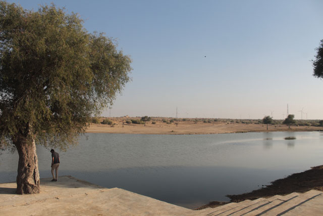
Munj Sagar, the largest water body in Dhar is attributed to Raja Munj. According to Wikipedia entry, there are traces of earthen ramparts on the bank of the talav built during the Parmar reign. The city was circular in plan and surrounded by tanks and moats. Its layout was similar to the fort of Warangal in Deccan. However, during my visit I did not see any remains of earthen ramparts.

AN00033913_001_l

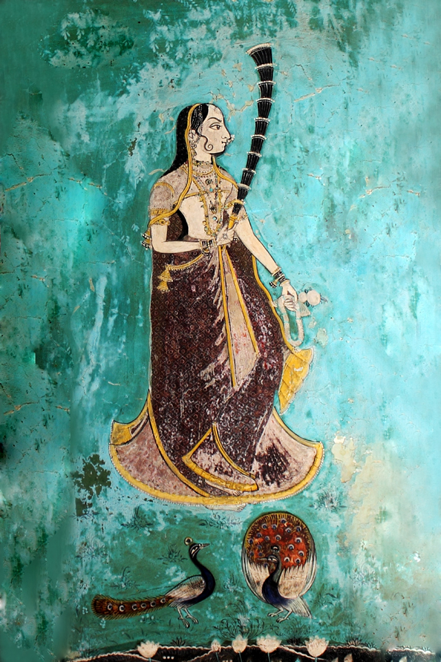
A Parmer Period Sculpture of Goddess Saraswati – Courtesy: British Museum

IMG_5921

Munj Sagar, the largest waterbody in Dhar

Bhoja Shala, the iconic monument of Dhar, was built by Raja Bhoja, which was later converted into a mosque by Dilawar Khan in 1392 CE, the founder of Malwa Sultanate. The columns used in the mosque are made out of recycled temple columns. In 1903, an inscription in Sanskrit was discovered by K. K. Lele, then Superintendent of Education of Princely State of Dhar. The text included part of a drama called Vijayasrinatika composed by Madana, the king’s preceptor who also bore the title Balasaraswati.

04

Bhoj Shala – The Earliest Parmar Monument Picture Courtesy: Parag Bhonsle

Bhoja Shala was a great centre of learning and housed a temple of Goddess Saraswati. Beside Bhoja Shala is a spacious enclosure containing four tombs, the most notable being that of Shaikh Kamal Maulvi or Kamal – al – Din. He was a follower of Hazrat Nizamuddin Auliya.

IMG_5952 copy

Tombs of Shaikh Kamal Maulvi or Kamal – al – Din

The pillar mosque or the Lat Masjid is yet another monument built by Dilawar Khan using the recycled pillars of Hindu temples. The mosque is named after three fragments of an iron pillar, called Lat in Hindi.

08

Lat or Pillar Mosque

A report published in the Journal of Asiatic Society in 1898 mentions: ‘close to the masjid is lying, in a sloping position against the terraces, a fragment of an iron column, or lat, a square of 10 inches on each side, and 24 feet long, with a Persian inscription of Akbar Shah, dated A.H. 1100, incised on its longer length; a second piece, similar and original belonging to it, is standing opposite the Jami Masjid at Mandugarh, being an octagon, 2 ft. 8 inch in circumference, with 10 inches of a circular end (showing another piece is missing), and 12 feet long. A third piece, a square 10 inches, with a bell capital, 6 feet high, is standing in the garden of the Maharaja’s guesthouse at Dhar. The total height of this remarkable column would be 42 ft. 8 inch less than the lat near the Qutub Masjid at Dhar… so far as can be judged from a description so deficient in details and unaccompanied by any illustration, the pillar at Dhar must, like the similar monument near Delhi, date from the Gupta Period’.

07

The Iron Pillar of Dhar

The iron pillars of Dhar displays the height of metallurgical skill in Ancient India. The mosque otherwise shows a fusion of local and Afghan architecture. While its colonnades have pillars showing Hindu and Jain carvings, its mihrabs and minbar reflect Afghan influence.

Dhar Fort

Dhar Fort, now in ruins, stands on a low hill to the north of the town of Dhar. It was constructed by Muhammad Bin Tughluq in 1344 CE over an earlier fort built by the Parmars. It is made of red sandstone and surrounded by ramparts with 26 bastions.

Dhar Fort1

05

Dhar Fort

A major draw of this fort is a large baoli, partly rock-cut, partly structural. The baoli, 30 feet deep was hewn in the 15th century. The fort also has significant remains of buildings of Malwa Sultanate, Mughal, Puars and British.

01

The Large Baoli inside Dhar Fort

Architecturally speaking, the most significant structure is the Kharbuja Mahal built in the Mughal Rajput style. It was here that Jahangir and Dara Shikoh, the eldest son of Shah Jahan took shelter. The palace got its name due to its musk melon shaped dome. Puars captured it in 1732 CE. During the Maratha struggle, Anandi Bai took shelter in this palace and gave birth to Peshwa Bajirao II. Later, Dhar Fort played a prominent role during the 1857 revolt.

Royal Chhatris 

A little known aspect of Dhar heritage is its chhatris, cenotaphs of the erstwhile Puar rulers. Located in Chhatri Bagh, a walled garden enclosure, these structures show excellent fusion of Mughal-Rajput and Maratha architectural styles. Most of the structures stand on plinths and are crowned with elaborate domes.

06

Royal Chhatris of Dhar

Water Structures

Dhar is a city of waterbodies. It has 12 and half talaos (reservoirs) and 35 baolis. Among the talaos, the largest and also the oldest is the Munj Talao. Covering an area of 50 acres, it was constructed by Raja Munja in the 10th century for the storage of drinking water. Devi Sagar is the second largest lake in Dhar. It was probably built during the time of Parmars. Kal Bhairav or Nat Nagara Lake is yet another large waterbody of Dhar.

Dhar2

The Munjsagar Talao of Dhar

Among the baolis, the most impressive is the recently discovered Munim Ji ki Baoli located near the fort. Based on its architectural style, it is believed to have been built in the 17th-18th centuries CE. The baoli is 3 stories deep and contains beautiful Mughal-Rajput arches.

03

Munimji ki Baoli – Dhar’s Most Impressive Stepwell

Jhirnia Baoli is located near the mandi. It is square in shape. One can reach almost up to the water table by descending a series of steps. The baoli was built in the late 19th century.

02

Jhirnia Baoli

Malusia Baoli is not exactly a step-well but a small tank attached to a temple. It is square in shape. Besides, these, there are a number of other small baolies scattered throughout the city.

09

Lesser Known Step-wells of Dhar

Though presently Dhar remains under the shadow of Mandu, where tourists throng throughout the year owing to its scenic location and larger number of monuments, Dhar is definitely more ancient and historically more diverse. For, in Dhar, one can witness the wonderful fusion of ideas from literature, music, art and architecture spanning at least a thousand years.  

Author – Jitu Mishra

He can be contacted at jitumisra@gmail.com

Mumbai – A Short History

Is this a fantasyland, a land where money grows on trees? Or maybe it is just a throbbing vein that attracts too many blood cells from all over. Be it the fish eating Konkanis, the carol singing Goan Christians or be it the Banias from the north, there is room for everybody. This is Mumbai. To an outsider it is a chaotic city full of dreams but for an insider it is a part of their life. As for me, it is where life truly moves on- be it the floods, be it a terror attack, I haven’t seen a bunch of people ever more disconnected and still in tandem. Mumbaikars pull together when in need and don’t mind shouting each other’s’ ears off in a railway train over a seat. Was Mumbai always like this; at odds with itself, wailing horns and constant traffic and not to mention the stinking gutters? Maybe we haven’t seen Mumbai in any other way but let’s not dismiss the fact that the roots of this city run deeper than we think.

Somewhere in the 3rd century BCE Ashoka found his way on an island in the Arabian Sea (Sopara). The existence of an Ashokan edict testifies the presence of Mauryan Empire in Sopara. They weren’t the only ones. These bunch of islands off the coast near the central region of India have welcomed not one or two but multiple visitors, whether guests or rulers; they’ve all left a stamp behind. The Gujaratis, the Marathas, the Mughals, the Portuguese and many others sport a link with Bombay.

After the Mauryans, the Shilahara Dynasty of Konkan came to the islands. These Hindu rulers have left a significant mark on these islands. Two very famous temples of Babulnath and Walkeshwar are from this era. The Walkeshwar Temple was constructed in the 10th Century and the Babulnath temple in 13th century. The Hindus ruled from around 810 CE to 1348 CE. In the mid-14th century, Gujarat Sultanate took over the reins of this area. Another two centuries and on 25 October 1535, the Portuguese came under the possession of Bombay. They weren’t to stay either.

Portuguese Bombay
Map of Portuguese Mumbai

Signing over her royal dowry, Princess Catherine of Braganza married Charles II of Britain on 8 May 1661. The royal dowry included the 7 islands that would later form Bombay. After a little tussle with the Portuguese, the English acquired the Bombay island and later on also added Mahim, Sion and Wadala to their kitty. By the Royal Charter of 27th March 1668, Charles gave away these islands to the British East India Company at a mere rent of £10 per year.

The Portuguese had built a Bombay Castle. The British East India Company set to work. They built a fortification around the Bombay Castle. They also constructed a quay and warehouses. Till then small economy had grown in Bombay. But the British wanted more. The fort wasn’t just a city but a potential gateway. Anyone with half a head could see that wasn’t it obvious? Mumbai was a natural harbour, very safe from the ocean yet deep enough for most ships and it was on the west coast. It was the perfect entryway into the Indian subcontinent.

Mumbaiharbour18thand19thcentury
Mumbai Harbour – 18th and 19th century paintings

By this time, Mumbai had had its first governor under the Company. They had also established the mint. Gerald Aungier, the second governor, formulated inviting business incentives. People began flocking to these 7 islands. They came here to settle and make livelihoods. Parsis from Iran, Marathis, Gujaratis, Christians, Muslims and Jews all gathered and lived in this city.

1855colabafort
1855 – View of the Fort from Colaba

Fast forward to 1838 and Bombay began looking like what it does today. In 1782 when William Hornby became the Governor, he decided to link these 7 islands of Colaba, Old Women’s Island, Mazagaon, Worli, Mahim, Parel and Bombay. He initiated the Hornby Vellard project. It changed the face of this city.

Fort2
Fort area as it looks today. Pictures courtesy : Jitu Mishra

Mumbai_03-2016_64_Dhobi_Talao_Chowk-300x240

As Bombay became the place for British Troops to set camp, they needed their laundrymen. The laundrymen needed a clean water resource. To create lakes, trenches were dug and filled. Several lakes constituted a part of this area around where today a big junction exists. The hospital opposite to the cinema now stands on top of a lake! When the government became building a subway for pedestrians under this major junction, they were surprised to find fresh water springs underneath! These springs filled the lake with fresh water and the dhobis (laundrymen) washed clothes here.

dhobitalaojunction
No lake anywhere in sight ! Dhobi Talao Junction. Picture Courtesy : Onkar Tendulkar

The first cotton textile mill was set up on 7th July, 1854. The shipbuilding industry followed in 1863.

Before Colaba became Colaba, there was a fort that covered the St. Thomas area called Church Gate. The extended Colaba area south of the fort was a village with green meadows. There were paths for leisurely strolling and thus the name Cotton Green.
As the docks were near, a cotton exchange was held to the east of Bombay Green. Over time, the cotton exchange got the name Cotton Green. As industrialisation gripped the city, the cotton exchange shifted north near the Sewri – Mazgaon area. A mint green colour building was built here and the cotton exchange started. Thus the new Cotton Green area was created.

1862bombaygreen

In 1862, Sir Battle Frere became the Governor of Bombay. He was ever the optimist and conceptualised the roots of Bombay. He decided to bring down the Bombay fort. It was too inconvenient and nascent, he had even bigger plans for this city.

The British troops housed overseas in India were undoubtedly homesick. They missed the revival gothic architecture and the upbeat vibes of urban London. Bombay was a quiet harbour and a clean canvas to draw upon. Sir Frere set off to build mini London.

The entire area of present day Churchgate and some parts of Colaba together formed the Fort area. The old fort had fortifications and three gates- the Apollo Gate, Church gate and the Bazaar gate. One of the gates stood right in the place of the famous Flora Fountain. Since this gate was close to the St. Thomas Cathedral locals referred to it as the Church gate. This name caught on and when the Colaba Station shut down, this new station was built near this gate and thus was christened Churchgate.

The fort and its gates were bought down to make way for a new Bombay.

1860churchgate
This is how the Churchgate area looked in 1860. Don’t miss the gate of the Fort at the fag end of the photograph
Churchgate
And this is how Churchgate looks today ! Pictures courtesy : Onkar Tendulkar

The excess money in the city went in to the stock exchange. A business elite class consisting of Sir Jamshedjee Jeejebhoy, Jagannath Sunkersett, David Sasson and Sir Premchand Roychund amongst others where the chief employers in the city. They banded together and gave a boost to Sir Frere’s dreams. They provided the finances and built huge legacies that are still around today. Libraries, hospitals, educational institutions, the Bombay Stock Exchange and the famous Prince of Wales museum as it was formerly known are all a part of that legacy.

mUMBAI fORT
Pictures courtesy : Jitu Mishra

Despite the rapid advancements, cattle were definitely a part of Bombay transport belonging to shepherds. In 1838 a new tax was imposed that made all herdsmen pay a tax for cattle grazing. In good faith Sir Jamsetjee Jeejeebhoy bought land near the Chowpatty till the Wilson College known as Thakurdwar. He let the herdsmen use this land for cattle grazing. Did you guess? What is the word in Hindi for grazing? Charna. This area thus came to be locally called as Charna. Soon it changed to Charni and we got Charni Road.

Charni Road
Charni Road as it looks today making it a tad difficult to imagine this was a grazing area not too many years ago. Pictures courtesy : Onkar Tendulkar

Textile mills ran this city once. Bombay was where India came, to haggle their wares to the foreign merchants. Cotton exchanges were an intrinsic part to Bombay and took place at Colaba. Cotton was turned into textile and exported here.

cottonexchange

There was a time when these mills fed the city. They had 2 shifts, one for the day duty and one for the night duty. Such was the demand for textiles. A common gong rang around the city at 9 signaling the shift timings. And then as if a light was switched off, all this came to an abrupt halt when the strikes began. Workers went on major strikes, forcing all mills to shut down, not for a day or two but permanently. Today there isn’t a single functioning textile mill around. Huge mills in the Parel area have given way to an industrial area and a shopping mall. The old mills are being brought down and in their place sky high skyscrapers are blocking the light. Those skyscrapers that hardly anyone seems to afford.

Whether it is the swelling crowds that is bursting the maximum city at its seams or its resilience against all odds. Mumbai is what it is today courtesy the British and not just in the way it looks and feels but also in the way it has exponentially developed in this short span of time. So, has this city finished evolving? Absolutely not. After 1995, Bombay became Mumbai again. The name comes from the local goddess Mumba devi. Many local names changed from sounding British to very much Indian. True for many railway stations in the country but that is another story for another day.

It might be ‘Mumbai’ for the world yet it is ‘Bombay’ for the city’s lifelong dwellers. They still catch a train to the Victoria Terminus (VT) now known officially as CST and we all know- Mumbai is our jaan. The railway local is its throbbing vein and the buses are the BEST in this country. By the way, Bombay is the refined version of the Portuguese word ‘Bom Bhaiam’ meaning beautiful bay. It’s an irony, is it not?

The cover picture is an engraving of the Horniman Circle area.

Author -Shanaya Wagh. She runs a website on historical trivia www.giglee.in

She can be contacted at editor@giglee.in

Datia Palace – Of Friendship, Mystery and Inspiration

The Delhi Durbar of 1911 was a major turning point in Indian urban history as it was during this event that the decision to shift the capital of Imperial India was taken. With Delhi now being crowned the capital, it was decided that a ‘New’ Delhi would be developed with sprawling avenues and majestic buildings.

Sir Edwin Landseer Lutyens, a reputed architect was chosen for the job. The 43-year-old immediately set out on an inspirational train journey through the heartland of the country carrying along with the baggage of scepticism and little appreciation for Indian symmetry and aesthetics. He was heavily influenced by classical European composition which the focal point of his layout plans for New Delhi. He maintained that the design was meant to demonstrate the superiority of western art, science and culture in India. Little did he realize that one palace was going to change all this.

IMG_9667

While travelling from Jhansi to Gwalior, Luytens saw two great palaces of Datia and was so impressed that he got off the train to visit them and returned for another visit. He was so impressed with Datia Palace’s blend of Hindu and Islamic styles that the fusion made its way in the design of New Delhi’s North and South blocks along with the palatial Rashtrapati Bhavan.

Travel Tips

Datia is a small town located on Jhansi – Gwalior Highway at a distance of 69 km from Gwalior and 325 km from New Delhi. The town is also an important Hindu and Jain pilgrimage centre. There are many temples, including the Sidhapeeth of Peetambhara Devi, Buglamukhi Devi Temple, and Gopeshwar Temple. Peetambra Peeth is a famous Shakti Peeth located at the entrance of Datia. The nearby Songiri has scores of Jain temples dated from the 19th century onwards.

While one can stay at Datia but we recommend nearby Orcha or Gwalior as better options for staying and food. MP Tourism runs a restaurant on the highway in Datia.

IMG_9751

IMG_9752

IMG_9767

IMG_9765

IMG_9753


Datia Palace, also known as Vir Singh Deo Mahal or Govind Palace is one of India’s most impressive palaces from the 17th century. Built essentially as a solid square fortress with very few openings to the outside the palace was hardly inhabited. The inside presents a marvellous geometric organization of space on several levels. Apartments inside have been built in such a way that there are proper cross ventilation and sufficient light without affecting privacy.

Also, Read Here:

Hill Forts of Jaipur – Jewels of Aravali

IMG_9769

IMG_9748

IMG_9724

IMG_9709

IMG_9714

IMG_9715

IMG_9671

IMG_9676

Within the solid square, there are four quartered squares with corner towers and a large courtyard at its core. The five-storied central tower (115 feet high) houses the royal apartments connected to the four corners with narrow bridges.

IMG_9712

The five-storied central tower of Datia Palace is one of the most innovative architectural statements among the palace buildings in India. According to experts, it is an expression of power and the authority of Vir Singh Deo, an exceptionally wealthy ruler of his time. According to Giles Tillostan, ‘the Govind Mahal’s tower, on the central plot, could, therefore, be regarded as a secular version of a temple shikhara. And just as in the temple ritual all action is focused towards the central point, so the dynamics of the Govind Mahal is focussed on the tower – it is the hub of the palace, visually a dominant feature, and the resident not of a God or the image of a God but of a King, and a king with a pretension to divinity’.

Also, Read Here:

Betwa – Flowing in the Heart of India

Vir Singh built the Datia Palace for his friend, Jehangir who could not come and stay. In 1627, he decided to gift it to his son who was the first ruler of Datia. Bhagwan Rao however never lived in this great palace. He lived nearby in a smaller palace, which is ruined now. Bhagwan Rao’s son Subha Kiran built his own palace at Datia on another outcrop. Subha Kiran’s son Dalpat Rao (1683 – 1707) established a fort/palace in the middle of the present Datia town. So, mysteriously this palace was never lived in!

The domed towers of Datia Mahal were once covered lavishly with Cuerda Seca glazed tile decoration. Compared to other architectural masterpieces of the time, here the glazed Cueda Seca tiles have a greater range of colours and floral designs.

IMG_9719

Cuerda Seca is a technique used when applying coloured glaze to ceramic surfaces. In this technique, waxy resist lines are used to prevent glazes of different shades from merging into each other during firing. The technique has its origin in Central Asia from the second half of the 14th century CE. From Safavids to Timurids to the Ottoman Empire, the technique was used profusely for tile decoration. The introduction of different coloured glazing is seen in the buildings of Samarkand from this period.

Also, Read Here:

Splendours of Orchha – Myths and Realities

Vir Singh Deo while accompanying Jehangir in different battle expeditions had received wide exposure to various art and architectural techniques in Samarkand and Persia. While building the Datia palace, he introduced many of these ideas creating one of the best examples of Indo-Islamic architecture. Call it a symbol of his friendship or a display of his status and power, Vir Singh in Datia Palace, has left us with a wonderful palace that is a treat to our senses.

IMG_9737

IMG_9738

IMG_9722

IMG_9761

IMG_9766

IMG_9770

IMG_9721

IMG_9718

IMG_9700

IMG_9694

IMG_9688

IMG_9686

Two large water bodies were constructed to the west and south of the palace. The western talav, which is called the Lalaka Talav has water, while the southern talav has turned into an open field. The talavs not just cooled down the palace in summer but also supplied water. These talavs also provided lovely views and cool place to serenade.

IMG_9745

IMG_9693

Datia Mahal

The southern talav was once a wide expanse of water with a little pleasure palace, Badal Mahal attached to it. A photograph by Lala Deen Dayal (1870 – 90) shows Govind Mahal and Badal Mahal besides the talav.


Courtesy – The British Museum 

Vir Singh Deo was a man of great taste. His taste for visual aesthetics is evident right from the entrance to the private apartments inside the palace. The murals painted on the spandrels of the main entrance depict human faced sun images on both corners above winged dragons. Both the winged dragons bear noble riders chasing gazelles through the foliage. The panel is undoubtedly one of the best in South Asia for its display of fevered energy and force. Above the scene is the painting of a seated Ganesha flanked by two horse riders.

IMG_9680

IMG_9681

IMG_9682

There is extensive use of Mughal motifs stylistically reconfiguring in Bundela guise. The 17th-century Bundela murals marked a transition phase, blending local style with Mughal cosmopolitan style, imagery and aesthetics. Inside the palace, there are richly layered expressions of local and cosmopolitan themes resembling closely the murals at Orchha Palace, Vir Singh Deo’s capital.

The net and star vaulted ceiling of Maharaja’s bedroom, Maharani’s dressing room and adjoining balconies are lavishly painted with Ragamala series replete with floral imagery in natural colours.  With the graceful appearance, sinuous shapes and lilting movements the murals of Datia exhibit a sophisticated approach to natural form.

IMG_9743

IMG_9729

IMG_9727

IMG_9744

Vases (guldan) in particular draw special attention. Illustrated in Araash technique, the vases taper from a wide curved base towards a narrow flaring rim. Long stems and leaves splay out from the vases’ lips in a vivid fan-like pattern.

The rasa-mandala ceiling located in the tripartite chamber on one of the palace’s lower ceremonial floors is one of the earliest extant depictions of this theme among Rajput palaces. The scene painted in relief was recently renovated by the ASI maintaining the original colour scheme – carmine, ochre, white and black. The circular composition is laid out around large flowering lotus resembling the moon that bathed the ecstatic dancing Krishna and his gopis in its light.

IMG_9702

IMG_9705

IMG_9706

The palace was visited in 1835 by Colonel Sleeman, a British soldier and administrator. A report published in Datia State Gazetteer states that when the Colonel asked the local maharaja’s servants why the Govind Mahal was abandoned they replied that no present-day ruler was worthy of such grand palace nor would one be comfortable living in a palace that had been built to house such a great king.

This suggests that Datia was already weakened around this time as a political power. Today, the Datia palace is in a desolate state with very few tourists visiting it. Though imposing in its structure, it takes an effort to imagine that only a century back it was a source of inspiration for New Delhi’s colonial architectural identity.


Author – Jitu Mishra

He can be contacted at jitumisra@gmail.com


Chandragiri Fort Museum – A Photo Story

Chandragiri on the Tirupati – Bangalore highway has an unusual address for an ASI Museum- Raja Mahal; a Nayaka palace located inside the Chandragiri Fort. The fort It is located in the Chittoor district of Andhra Pradesh. Unusual because down South, fort palaces are hardly converted into museums, yet it is the perfect setting for displaying the excavated remains from the archaeological sites of Yaganti and Chandragiri and also of the bronzes and stone sculptures that are remnants of the artistic splendor of the Vijayanagara period (1336-1565 CE ). The empire at its zenith ruled most of South India and was considered its rule was marked with artistic and cultural advances among many others.

The address was once the palace of Chandragiri Nayakas, those very Nayakas who came to the rescue of Vijayanagar Rayas after the battle at Talikota. Chandragiri became  the capital of the Rayas. The fort has been attributed to Shivappa Naik of Yadava Naik dynasty and is more than a 1000 years old. Its most glorious period was under the Vijayanagara rule when it was made the capital of the mighty empire.

IMG_6308.CR2

The Raja Mahal is architecturally akin to the Lotus Mahal at Hampi. It is a three storied palace crowned with towers in Hindu architectural tradition. Arches are used to bring in a feel of space and lightness. It is constructed with stone, brick, lime and mortar devoid of timber. The floors are supported by massive pillars. The central tower that covers the durbar hall rises through the two floors. The floors are supported by massive pillars while the walls bear fine plaster and stucco decorations. The six tiered pastel hued Raja Mahal, built in Indo – Sarcenic style, set amidst manicured  lawns and surrounded by the Chandragiri mountains  is  an inspired setting to showcase  the rich legacy of Vijayanagara art and architecture.

ASI at Chandragiri is a modern day avatar  of the Nayakas. It  is restoring the glory of regional architecture much like it did of the Vijayanagar empire!

IMG_6194.CR2

The museum houses rich artefacts found in Andhra Pradesh. The findings displayed  are from Gandikota, Yaganti, Chandragiri, Guddimallam, Cuddapah district and Kurnool district. The idea is to showcase the rich regional and material heritage of the area whose history goes back to thousands of years. Although most of the exhibits belong to the 16th and the 17th centuries and are in the artistic Vijayanagara style , yet the subtle local influences are discernible. Walking down the corridors, reading the tags , barely  familiar with the sites the mind is suitably challenged and pleased at the same time.

IMG_6234

The arched corridors along which the regally robed Rayas once strolled , discussing war strategies with their commanders, now house stone sculptures discovered in the region . Who can tell what secrets these mute stones have heard and hold , sealed , within themselves !


_DSC6807 corrected
Pic credit – Jay Shankar

A single file of lovely stone icons salvaged from Gandikota and Renigunta is headed , auspiciously,  by a Ganesha from Renigunta

_DSC6755 corrected

Vishnu in lalitasana. Notice the fine details chiseled with perfection in stone. Pic credit – Jay Shankar


_DSC6691 corrected
Pic credit – Jay Shankar

Above : Soma Skanda and Parvati; Below : Details of the upper body and clothes of Parvati. The Vijayanagara rule saw a gradual transition from Chloritic Schist to Granite for sculptures. Though soapstone was still preferred but granite was being increasingly used leading to sublime pieces like the above one. Pics credit – Jay Shankar

IMG_6231.CR2

The Alwar saints sitting in calm repose.

The highlight of this floor is the Navagraha collection retrieved from the Uma Maheshwara temple at Yaganti

IMG_6236

One of the Navagraha to help you understand the depth of sculptural beauty of this region.

IMG_6239

Who else but Chandra, the  Lord of Chandragiri

The scene stealer of the ground floor or rather of the museum is the Bronze gallery. The Vijayanagara bronzes follow the tradition set by the Chola bronzes. These are panch kula or five metal icons; Copper, tin, zinc, lead and traces of gold and silver were used in casting these icons with most of them being Utsav moortis that were cast using the lost wax process.

The bronzes displayed at the Chandragiri museum belong to the later Vijayanagar period. These are classified as lesser Vijayanagar and closer to later provincial Chola bronzes.  Experts feel that these are more stylized, less natural and heavily cold worked as seen in the hatched designs.

But to the  untrained, uncritical eyes all look sublime, sensuous and supreme!


Vishnu in his many forms. Pics credit – Jay ShankarIMG_6140 (2)

Lakshmi Narasimha

IMG_6138.CR2

Bal Gopala

Although the Rayas patronized Vaishnavism, the local Nayakas were Shaivas. At Chandragiri we see this icono-eclecticism

_DSC6676 corrected

Soma Skanda and Parvati. Pic credit – Jay Shankar

_DSC6851 correctedPoet King Krishna Deva Raya with his consorts. Pic credit – Jay Shankar

The reservoir at the base of the hillock collected rain water and made the fort self – sufficient. Today, it is used for pedal boating. There is a light and sound show in the evening that gives a general overview about the history and cultural significance of this place. For both history buffs and art connoisseurs, the corridors and halls of the palace are no less enthralling as they are enlightening and educative.IMG_6306

One long lingering look as you walk out of the palace thanking the ASI DG Mr. Tiwari who gave the timely permission to take photographs and the Senior Conservationist Mr G. Srinivasulu who made the visit memorable.

IMG_6312

This  too is a teertha, a place of pilgrimage, albeit of a different kind.


All the pictures used in the post belong to the author unless stated otherwise. Cover pic credit – Jay Shankar

Author – Aparna Pande Misra

She can be contacted at aparna.anusha.28@gmail.com