Dholavira – India’s First Water Tech Park

From Kashi to Maheshwar and Ekamra to Adalaj, one sight that is common to all is ghats on rivers, tanks or step-wells – all pointing to one idea, India’s spiritual journey through life-giving force, water.

Ghat refers to a series of steps leading to a water body, either a holy river or a small pond and in western India even step-wells. From the beginning of Indian civilization Indians have understood how water was critical, not just for biological survival, but also to meet our spiritual quest.

In Indian tradition ghats in step-wells are like bridges linking with the tropical Indian sun to a clear pool of water. Through these ghats, people travel from one realm to another. The weakening light descending the ghats conveys a sense of passage deep into the womb of earth, moving further into darkness. The experience is spellbinding. With no ripples, bubbles or sound, the pool has an eerie comforting silence. Here time stands still and you forget that anything is urgent.

Gujarat, Rajasthan and Western Madhya Pradesh are a large semi-arid plateau with limited perennial water sources. Here the idea of water harvesting has found deep meaning and its origin can be traced to the mysterious Harappan time, 4,500 years ago at Dholavira in Khadir Island of Rann of Kutch.
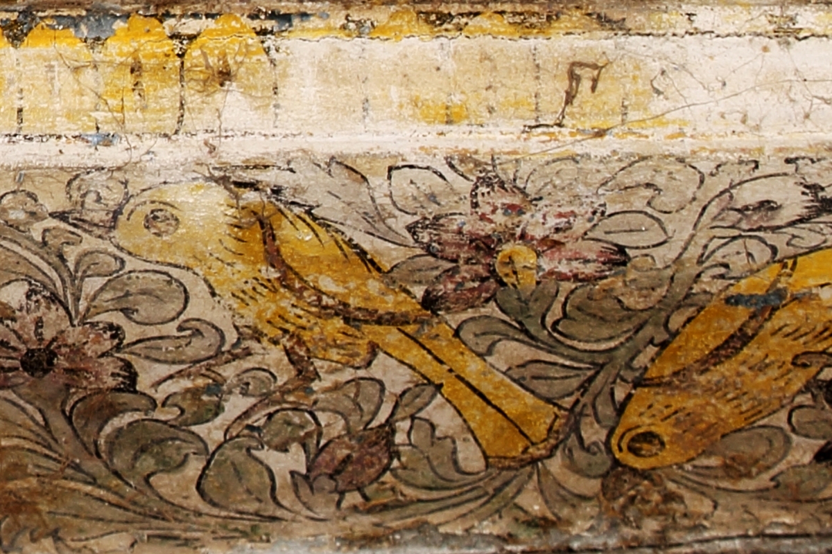
img_6790

Ghat at Maheshwar

The Indus Valley Civilization (3300 – 1300 BCE) is the earliest civilization of South Asia. It is one among the few old world civilizations that had developed through intense agricultural activity based on wheat and barley and domestication of animals, such as sheep, goats and cattle. In its matured phase (2500 – 1700 BCE) the civilization had spread from Afghanistan in the west to Western Uttar Pradesh in the east and South Gujarat – North Maharashtra region in the south. It was spread over an area 680,000 sq.km, an area twice the size of Egypt and Mesopotamia Civilizations.

Gujarat was the southern province of the civilization. Around 2500 BCE, the inhabitants of Indus Valley Civilization had moved to Kutch region from the core area of Indus Valley. So far 60 Indus Valley settlements have been found in Kutch. Dholavira is located in Khadir Beyt, an island in the Great Rann of Kutch. It is the largest among all the Indus Valley settlements in Gujarat.

Kutch is an undulating terrain consisting of rocks, hills and Arabian Sea with no perennial source of surface water. The region is marked by inadequate rainfall. However, the main attraction is the pasture lands and the long coastline. Against this harsh climatic condition water exploitation and management was one of the key challenges for the Indus Valley people.

img_8207

img_8273

img_4787

img_4783

img_4740

img_8253

Landscape and People of Kutch around Dholavira

Today Kutch is separated from Indian mainland my marshy rann, but during the 3rd millennium BCE, rann was probably an open sea. Agriculture, fishing and pastoralism were the main activities of the inhabitants of the region during the period of Indus Valley Civilization.

Dholavira was one of the last among the major cities discovered so far from the Indus Valley Civilization. The site was excavated by archaeologist Dr R S Bisht between 1989 and 1998. The city had both striking similarities to Mohenjo Daro and Harappa and significant differences. It was over 100 hectors in size and consisted of 3 tiers of settlements, such as a citadel, the middle town and the lower town. In contrast, both Mohenjo Daro and Harappa though bigger in sizes had two tiers, a citadel and the lower town. Dholavira, unlike its counterparts, was located on an island of a shallow sea. Stone was used for its construction whereas bricks dominated as construction material in other Indus Valley cities.

Travel Tips:

Dholavira is located in Gujarat’s Kutch District at a distance of 400 km from Ahmedabad and 220 km from Bhuj (both have airports and railway stations). The nearest town to Dholavira is Rapar, 100 km away. Rann Resort (https://www.rannresortdholavira.com) is a latest addition for comfortable stay at Dholavira, located 3 km before the archaeological ruins. While at Dholavira also visit the Jurassic Wood Fossil Park and go for long hiking in the remote countryside. Both Sunrise and Sunset in White Rann of Kutch are spectacular. You can see migratory birds, such as flamingos during winter, which is also the best season to visit. Keep 3 days for village visit and Rann safaris at Dholavira.  

The earliest settlement at Dholavira is traced around 3000 BCE. Around that time a small town developed, surrounded by a wall of stones and clay mortar. At the beginning of the Harappan phase, i.e., around 2500 BCE a citadel was erected over the earliest settlement. It grew in size in subsequent periods.

Also, Read Here: 

Rogan Art – A journey from the Sindh to White House

Beyond the citadel’s walls was a walled residential area (the middle town), with cardinally oriented streets and with jars and sumps instead of drains. Houses in the middle town had verandas, interconnected rooms and bathrooms with sloping slabs for water to flow into a covered drain that extended into the streets.

dholavira 164

The Central Thoroughfare in the Middle Town

Dholavira is located in a seismic zone. It had suffered badly by an earthquake around 2200 BCE. Then after the city was rebuilt and extended to the east (lower town). After 2000 BCE, the city saw a decline and was eventually abandoned.

Also, Read Here:

Ajrakh – A Journey with Dr Ismail Mohammad Khatri

Dholavira is located in-between two seasonal streams Manher and Mansar. Both these were seasonal bringing water from the hill slopes during monsoon. The early settlers must have felt necessary to dam them, which they did. Here we find South Asia’s oldest check dams over the streams built by the Harappans.

img_2811

img_2812

img_2813

A Check Dam Built Over Manher During Harappan Period – One of the earliest in South Asia

Once dammed, the early settlers facilitated a rock-cut well, the earliest South Asia. Excavated during the 1990s, the rock-cut well is found at the bottom of the earthen reservoir, the most elaborate and largest among 13 reservoirs that surrounded the Indus Valley city through interconnected sluices and channels. The rock-cut well has few rock-cut steps and stone made an enclosure of later date.

img_1990

img_2804

img_2806

The Earliest Rock-Cut Well in India

The eastern reservoir and five of the series to the south of it are considerably exposed through excavations. The remaining ones are confirmed through trial digs. The eastern reservoir is of the rectangular shape measuring 75 m N-S and 30 m E-W and 10 m deep. At three corners the reservoir was provided with a flight of 30 steps. This reservoir was constructed however in the matured phase and it was accessible to all the city dwellers living in the citadel, middle town and lower town. It was fed with water from Manher largely.

img_7901

img_4669

The Eastern Reservoir

The other five on the southern side are of varying sizes and depth, partly cut through the alluvium and partly through the bedrock, displaying South Asia’s eeriest evidence of rock-cut architecture. Two masonry flights of steps led to their interiors. All the tanks were interconnected with drain carrying water into each other.  The surplus water finally flowed out through a masonry drain into another series of reservoirs excavated further west.

Also, Read Here:

The Port of Ghogha – Where India met Arabs

img_7954

img_7953

img_7938

img_7901

img_7926

img_7951

img_7958

img_7959

img_4684

img_4685

img_4689

dholavira 094

dholavira 108

dholavira 114

The Citadel has revealed an intricate network of stormwater drains, all connected to an arterial one and furnished with slopes, steps, cascades, manholes (air ducts/water relief ducts), paved flooring and capstones. The main drains were high enough for a tall man to walk through easily. The rainwater collected through these drains was stored in yet another reservoir that was carved out in the western half of the bailey.

dholavira 046

dholavira 047

img_1987

dholavira 053

dholavira 059

dholavira 060

img_1960

img_1979

img_1981

img_1985

img_1986

img_4680

img_8029

img_8006

Besides rainwater harvesting, Dholavira has yielded toilets, sullage jars or sanitary pits. Drains even included cut stone ones and pottery pipes.

img_8148

img_8133

img_8036

dholavira 229

dholavira 228

dholavira 226

dholavira 236

dholavira 174

dholavira 173

dholavira 144

Dholavira declined around 1500 BCE and was never revived as an urban centre. There are multiple causes attributed to its decline. But its concern for water harvesting did continue throughout Indian history. The step-wells in Gujarat and Rajasthan and Puskarinis in South India are examples of attempts of future civilization to harvest water, a legacy from the Indus Valley Civilization and Dholavira perhaps.

img_9497

img_8788

img_8345

Author – Jitu Mishra with inputs from Shailaja Shah

He can be contacted at jitumisra@gmail.com


Rogan Art – A journey from the Sindh to White House

Roughly 400 years back an art was introduced to Kutch from Sindh, thanks to the Raos of Kutch who deeply appreciated art. Called ‘Rogan’, the art however declined due to the lack of patronage with the passage of time. Only a few local Ahir and Rabari women would buy bridal skirts filled with Rogan art from the Sindhi Khatris (Kutchi speaking Muslim ancestors of the Khatri families settled in Nirona Village where the Rogan art thrives).

IMG_1362

Rogan means ‘oil based’ in Persian and refers to the thick residue formed when castor oil is heated along with water for over three days. The pastes of yellow, red, white, green, black and orange are kept in earthen pots with water to keep them moist.  After the paste is mixed with these natural colours, the residue is drawn out into a fine ‘thread’ with a wooden stick and applied to the cloth.

IMG_1387

IMG_1369

IMG_1366

Travel Tips

Nirona Village is located 40 km north of Bhuj City in Gujarat’s Kutch District. To reach the village you have to make a little detour from Bhuj Khavda Highway. The village is a large settlement inhabited by Khatris and other caste groups. Apart from Rogan you will also discover two other craft forms – the bell metal work and lacquer craft. There is no staying facility here. However, you can arrange your stay at Bhuj or some other ethnic resorts near White Rann around Khawda area. Rizwan Khatri can be your local contact at Nirona (91 9601324272)

The painting process is tedious and time consuming and depending upon the nature of design it may take up to a month to finish. First the outline is drawn which is filled and once the pattern is dry, natural colours are added. The process is repeated time and again till the desired effect is not achieved. In the case of symmetric patterns, to reduce the work effort, the fabric is folded from the center to get the impression from the other half. Drying usually takes 2 to 3 days.

Also, Read Here:

Ajrakh – A Journey with Dr. Ismail Mohammad Khatri

There were many Khatri families involved in Rogan art, but except two families most of them have switched to other trades. Abdul Gafoor, a young Khatri also followed suit and went to Ahmedabad and finally Mumbai in search of greener pastures. It was in 1983 that Abdul Gafoor took to Rogan art with renewed vigor and promised his father that he would take it to the international level one day. His promise was fulfilled when his work was presented to US President Barak Obama by Prime Minister of India Narendra Modi thanks to a Gujarat Government project that aimed at reviving the art by helping the Khartis of Nirona in 1980s.

Also, Read Here:

Reza – Journey from the Indus Valley to a Fashion House

‘Tree of Life’ has become a trend in recent years. Influenced by the Persian and Mughal carpet design ‘Tree of Life’ is done over cushion cover, bedspreads, kurtas, curtains, tablecloths, wall hangings, purses and so on.

IMG_1415

IMG_1393

IMG_1410

IMG_1411

IMG_1413

IMG_1414

During my recent visit to Nirona, I met, Arab Hashim Khatri, Gafoor’s uncle whom I interviewed.

IMG_1383

Most of the online resources, magazines and newspapers have reported about only one Khatri family of six people who have revived and retained the Rogan art. However, I met Rizwan Khatri from another family in the village who is equally well established in the craft. Traditionally Rogan was a man’s stronghold so it was interesting to see that both the families have started training local women to further the craft and its popularity.


IMG_1418

IMG_1421

IMG_1420

Rogan Art in Contemporary Fashion Design – Creations by Rizwan Khatri


Author- Jitu Mishra

He can be contacted at jitumisra@gmail.com

Ajrakh – A Journey with Dr. Ismail Mohammad Khatri

For an archaeologist from South Asia such as me, what could be a more precious discovery than the Priest King of Mohenjo-Daro! Archaeologists have been debating on his role and position in Indus Valley society, but for those who are inclined towards aesthetics and art they are fascinated with his shawl depicting trefoil patterns interspersed with small circles – the fusion of three sun-disks of the gods of earth, water and the sun. That is Ajrakh, South Asia’s oldest textile tradition of block printing.

8yGMG1K

5000 years later the tradition still prevails in Sindh and the artisans still use the same methods of production that were used in the days of the Indus Valley civilization to create an ajrakh fabric. Ajrak is derived from the word Azrak, meaning blue in Arabic as blue happens to be one of the principal colours used in Ajrakh printing.

Video 1


(Images Source – Jay Shankar)

The Raos of Kutch had invited a group of Sindhi artisans to Kutch for introducing the art in the region. They first settled in a village called Dhamadka near Bhachau, the epicentre of 2001 earthquake.

Travel Tips

Ajrakhpur is a small village at a distance of 10 km from Bhuj on Bhuj – Gandhidham Highway. Bhujodi, the craft village is just 3 km away from Ajrakhpur. The village has been established after the 2001 earthquake. You can meet Dr Ismail Khatri with a prior appointment ( 91 9925169313). He or his son Sufian (91 9427719313) would be happy to show you the entire process of Ajrakh block printing. The best season to visit is in winter (November to February). Bhuj can be your base for accommodation.  

IMG_2191

IMG_2200

Dr. Ismail Mohammad Khatri, the man behind the successful revival of Ajrakh printing using natural dyes, told us about the context of their arrival in Kutch while introducing the art and the significance of blue colour.

Video 2

The indiscriminate cultivation of Indigo in Bihar and Bengal affected its production in Kutch. In 1840s, organic colours were introduced in Europe – indigo for blue and alizarin for red. These were produced in industries on a large scale replacing the organic colours and lowering the cost of fabric. Eventually the Kutchi farmers forgot the knowledge of organic dye production and instead used the cheaper but hazardous European synthetic colours.

Also, Read Here:

Patan’s Patola – A Weaver’s Perspective

Dr. Khatri explains how the revival took place with changing time and people’s change in taste and occupations.

Video 3

Ajrakh printing is a long process involving different stages of printing and washing the fabric over many times with various natural dyes and mordants such as herda, lime, alizarin, indigo, tamarind paste and even camel dung.

Also, Read Here:

Reza – Journey from the Indus Valley to a Fashion House

IMG_2211

IMG_2216

IMG_2206

IMG_2204

An ajrakh fabric is usually about 2.5 to 3 m in length. The printing on the fabric is done by hand with hand carved wooden blocks of various designs. A number of wooden blocks depicting different designs are used to print repetitive patterns, the characteristic feature of ajrakh. These blocks are made by synchronizing the patterns perfectly. Making these perfect blocks is indeed a huge challenge.

IMG_2233

IMG_2229

IMG_2251

IMG_2254

Ajrak print is done within a grid, the repetitive patterns creating a web-like design. Borders are then added employing specific designs. These borders are aligned both vertically and horizontally and frame the centre, separating one ajrakh.

IMG_2196

IMG_2193

IMG_2197

IMG_2194

IMG_2263

Once the printing is done, it is left for dyeing. The process is repeated time and again with different kinds of dyes to eventually achieve the final desired pattern. It is a very labour intensive and time consuming process taking upto two weeks to create a single piece with an eye-catching print.

Also, Read Here:

Rogan Art – A journey from the Sindh to White House

In this entire process the role of water is critical. There are 30 steps through which an ajrakh fabric passes and each step involves washing. The water influences not just the character of the fabric but also its colour and shade.

Dr. Ismail Mohammed Khatri is an institution as far as Ajrakh printing is concerned. He traces the origin of his community to a village called Santreja in Sindh. In the 16th century during the reign of Rao Bharmal I, JindaJiva, his ancestor was the first artisan to settle in Dhamadka in Kutch. In the video, Dr. Khatri traces his journey from being an humble ajrakh artisan to a PhD on the subject.

Video 4

From Dhamdka to Ajrakhpur – A New Beginning after 2001 Earthquake

The river adjacent to Dhamadka village provided regular and easy supply of good quality water for ajrakh printing work. But after 1991, the river started drying up resulting in the lowering of water level in tanks and wells of the area.  The 2001 earthquake destroyed the village itself forcing Dr. Ismail Khatri and others to migrate to a new place. How did it happen – watch the video to know what challenges were faced in the settling of the village of Ajrakhpur.

Video 5

Author –  Jitu Mishra

He can be contacted at jitumisra@gmail.com

The Port of Ghogha – Where India met Arabs

Gulf of Khambhat previously known as the Gulf of Cambay had been India’s magnet to pull ideas and resources throughout the history. Situated between the Saurashstra Peninsula and the mainland of Gujarat, it receives drainage from a number of rivers, the prominent ones being  Narmada, Tapi and Mahi Sagar and has the highest known tidal range in India.

Ghogha1

Gulf of Khambhat – Source: Google Earth

From the rise of Indus Valley Civilisation till the fall of Mughal Empire, the coastline of Gujarat was dotted with ports and cities that were a hub for trading in cotton, silk, spices, timber and many more goods. The trade was done on a global scale with Arab and East Africa in the west and Indonesia in the east and later with European nations.

Also, Read Here:

The Dutch Connection – Katargam Cemetery and Hortus Malabaricus

IMG_2184

Dutch Tombs on the bank of Tapi at Surat on Gulf of Khambhat

IMG_7277

The Mecca Gate at Khambhat – through this gate pilgrims used to sail to Mecca for Haj in the Medieval Period

IMG_7416

The River Sabarmati, before it meets the Gulf

The Periplus of the Erythraean Sea, a Greek historical resource on navigation, written between 1st  and 3rd century CE, refers to the Gulf as – Beyond the Gulf of Barca is that of Barygaza and the coast of the country of Ariaea, which is the beginning of the kingdom of Nambanus and of all India. That part of it lying inland and adjoining Scythia is called Abiria, but the coast is called Syrastrene. It is a fertile country, yielding wheat and rice and sesame oil and clarified butter, cotton and the Indian cloths made therefrom, of the coarser sorts. Very many cattle are plastered there, and the men are of great stature and black in colour.

The metropolis of this country is Minnagara, from which much cotton cloth is brought down to Barygaza. In these places, there remains even to the present time signs of the expedition of Alexander, such as ancient shrines, walls of forts and great walls. The sailing course along the coast, from Barbaricum to the promontory called Papica, opposite Barygaza and before Astacampra, is of three thousand stadia.

Periplous_of_the_Erythraean_Sea.svg

Source: Wikipedia

The gulf’s archaeological journey begins at its head in Lothal, the famous Indus Valley port city that flourished between 2500 and 1900 BCE. Lothal was supposed to have been approached by sea. At present Lothal is separated by a distance of 20 km from the head of the gulf.

Also, Read Here:

Mandvi’s Sea Trade – A Pilot’s Story

IMG_3865

IMG_3881

IMG_3887

The Indus Valley site of Lothal

Between the 5th and 8th centuries CE, a large part of Gujarat was under the rule of Maitrakas with Vallabhipura as their capital. Today Vallabhi is separated from the Gulf for about 35 km, but according to local legends corroborated by archaeological sources, the capital was once in close proximity to the sea. It was also an important centre of Buddhist and Jain scholarship.

Travel Tips

Ghogha is a small village on the shore of Gulf of Khambhat near Bhavnagar City. Ghogha can be approached from Ahmedabad and Vadodara and other important cities of Saurashtra by road and by rail up to Bhavnagar. It takes about 4 hours to reach Ghogha by road from Ahmedabad. There is also ferry service between Dahej and Ghogha on the Arabian Sea (https://www.dgseaconnect.com/). There is no accommodation available at Ghogha. However, the nearby Bhavnagar has a range of stay options. While at Ghogha also visit Alang, Asia’s largest ship breaking site.

South_Asia_historical_AD590_EN.svg

Source: Wikipedia

Ghogha, situated on the mid-western bank of the Gulf and about 35 km from Vallabhi, was an ancient port  Gundighar. A large number of copper plates  found in the Ghogha region suggest that the inhabitants  of the area  were involved in agriculture, animal husbandry and sea trade.

Ghogha2

Ghogha3

IMG_5015

Ghogha Village on the Gulf

IMG_4983

IMG_4986

IMG_4984

There are interesting stories as to how Ghogha got its name. A type of molluscan shell called ghoghla in the local dialect are found in plenty at the site. According to a popular belief, Ghogha was named after this molluscan species. Yet another story goes, sailors of the Ghoghari community used to camp at Ghogha. They had a strong masculine appearance and the local population was scared of these heavy set sailors prompting mothers to sing at night ‘suo suo bava ghoghra avya’…. Sleep soon an old ghoghra has come.

Also, Read Here:

Patan’s Patola – A Weaver’s Perspective

The prosperity ushered in by the Maitrakas attracted traders and merchants to Ghogha from foreign shores, especially the Arabs. They were greeted by the local Hindus, Buddhists and Jains as they bought good business to the region. They were absorbed by the local population who provided them with facilities to settle, acquire lands and openly practice their religion.

At  Ghogha, the  Arab merchants built a mosque, which according to some historians predates to the time of Prophet Muhammad. The Juni Masjid or Barwada Masjid as it is called is situated on the northern edge of the village. It was, until recently, in a highly dilapidated state. Unfortunately, the mosque is neither protected by the ASI nor State Archaeology Department. To prevent it from further deterioration, the local committee with no knowledge of conservation is now restoring the entire structure. The Barwada Masjid in Gujarati translates as outsider’s or foreigner’s mosque.

IMG_5014

IMG_5008

Entering this 15×40 feet structure, I noticed that its Qibla / Mihrab faced Jerusalem instead of Mecca. Between 610 and 623 CE, the first 13 years of Islam, Muslims prayed to face ‘Baitul Muqaddas’ or the Al Aqsa Mosque in Jerusalem. In 623 CE, while offering namaz in Medina, Prophet Muhammad had a revelation and declared that Muslims were to pray to face the Kaaba in Mecca. Since then, Muslims all over the world stopped facing Jerusalem and the Qibla was changed to face the Kaaba.

At the Barwada Mosque, the Qibla, indicated by the position of Mihrab (a semi-circular niche in the wall facing which prayers are offered), faces Jerusalem, an angle 20 degree north of the Qibla towards Mecca. This speculates to its date of construction before 623 CE. And if so then this is without any doubt the earliest mosque in India. Built in 629 CE in Kodungallur taluka of Thrissur district in the state of Kerala, the Cheraman Juma Mosque is considered to be the oldest mosque built in India.

IMG_5002

IMG_5006

IMG_5001

IMG_5000

IMG_4994

IMG_4995

IMG_4997

There are other archaeological pieces of evidence that corroborate the presence of Arab traders in Ghogha as early as 7th century CE. A number of stone anchors of Indo-Arabic origin are seen lying in the inter-tidal zone near the lighthouse of Ghogha. Because of the high tidal range here, these anchors lying at a depth of 5-10 m get exposed during the low tide.

IMG_4952

IMG_4955

IMG_4956

IMG_4957

IMG_4959

IMG_4961

IMG_4964

IMG_4966

IMG_4967

IMG_4968

IMG_4970

IMG_4971

IMG_4981

Indo-Arabic anchors are typically made from vertical stone blocks, often square in cross-section, with two rectangular or square lower holes, and a circular upper hole. One of the anchors has wide grooves on all four sections and is probably of Chinese origin.

454-07

Source: Internet

Similar anchor stones have been reported from other sites of Saurashtra coast, such as Dwarka and Beyt Dwarka, but the quantity found at Ghogha is overwhelming. According to archaeologists, Ghogha may have been a manufacturing hub of Indo-Arabic anchor stones. This is assumed because of the discovery of a lone anchor stone without a hole.

Ghogha is also the only archaeological site where stone anchors have been found with Islamic glazed pottery. During my visit to Ghogha, I came across a few pottery pieces with blue, green and brown glaze. These were fragments of ring footed base bowls, dishes and storage jars. The discovery of glazed pottery also suggests that this area was used for loading and unloading of cargo by the Arab traders.

IMG_4974

IMG_4973

IMG_4975

These traders from Arab and the Persian Gulf introduced Islam in Gujarat. Many of them married local women adopting the local Gujarati language and customs over time. Ghogha continued to be a major port until the rise of Bhavnagar in the 17th century CE. Its importance as a thriving port is also noticed in a local proverb ‘Lanka ni ladi ane Ghoghano var’, which translates to ‘the bride of Lanka (Sri Lanka) and groom of Ghogha’.

However, its prosperity was also a cause for its decline. Ghogha was attacked and conquered several times by rulers such as the Gohil Rajputs and Sultans of the Medieval Period, gradually weakening its economy.

Today, Ghogha is lost in time. It is a village with dusty roads and poverty all around. By looking at its present condition it is hard to believe that once upon a time ships from various nations, especially from Arab, dropped anchor here bringing in new ideas and faiths.

Author – Jitu Mishra

He can be contacted at jitumisra@gmail.com

Patan’s Patola – A Weaver’s Perspective

There is an old Gujarati proverb on the Patola that goes something like this – “PADI PATOLE BHAT, FAATE PAN FITE NAHI”. This roughly translates to ‘ The design laid down in patola shall never fade even when the cloth is torn.’

img_2653
A Patola Pattern

With a guarantee of lasting close to 100 years and a design that can be worn any side, Patan’s famous Patola are no wonder a prized possession, a wedding trousseau essential, a heirloom and definitely one of the finest silk sarees of our country. It is the only form of the painstaking double ikat weave available in the world!

Some Common Patola Designs

One of the oldest forms of textile weaving is ikat – a dyeing technique used to pattern textiles. The word ‘ikat’ is derived from the Malay-Indonesian word ‘mengikat’ which translates to ‘to tie’. Among the different forms of ikat, the most impressive and tedious to weave is the double ikat. Patola sari of Patan is one such example, which for nine centuries now has remained as a proud icon of Gujarati heritage.

Patola  Making  in  Process

According to a legend, Anhilwad Patan was founded by Vanraj Chavda in 746 CE. It was the capital of medeival Gujarat till early 15th century, until Ahmed Shah decided to shift the capital to Ahmedabad. Kumarpal was a Jain king and always wrapped fresh patola fabric while performing his daily prayer. The patola worn by Kumarpal was specially imported from South India. But one day, he was told that the patolas he draped around his body were impure as these were used by the king of Mugapatnam before sending them to Patan. Kumarpal got annoyed and immediately invited 700 Salvi families to Patan so that he could be assured of fresh fabric.

Geometrical Designs in Rani ni Vav and in Wooden Havelis  

Patola was a major trade item on all the trade routes and was also used as a high denomination currency by few. Historical sources suggest that among the Dutch merchants, Patola was a symbol of aristocracy and power because of its high price and exclusivity and used them during the 17th and 18th centuries AD for establishing trade posts in Surat and Ahmedabad. It is also referred to in the travel accounts of Ibn Batuta (14th century) and Tavernier (17th century). Ibn Batuta mentions that Sultan Ala Ud Din Khilji had received a patola from Deogiri, identified with modern Daulatabad in Maharashtra. Patola is also depicted in the murals at Mattancheri Palace in Kochi in 17th century CE. Indonesia, the birthplace of ikat, was a large importer of Gujarati patola till World War II.

The Salvi familes of Patan are well-known for their contribution to patola weaving. They were Jains originally belonging to the Digambara Sect in South India. After moving to Patan, they converted to Shwetambara sect. Though Patola weaving was exclusive to them, in recent years families from other communities too developed skills and expertise in the fine art of patola weaving. One such family are the Sonis which runs a studio-cum workshop under the brandname of Madhvi Handicrafts. Though a new entrant in the field, Mr. Sunil Soni, its founder has created a niche for himself as a master weaver, in a short span of 25 years. His relentless fight for patola’s revival ended after Patola received geographical indication (GI) for Patan. His work received a shot in the arm when his son Shyam, a software engineer by profession, left his lucrative job to join his father in promoting this exclusive art which is fast fading.

On my recent visit to Patan, I got a chance to interview Shyam. Do watch the video for more on the story of the saree, its varieties and the meaning of the symbols printed on it


Author – Jitu Mishra

The author can be contacted at jitumisra@gmail.com

The Dutch Connection – Katargam Cemetery and Hortus Malabaricus

Remember your Class 8 History textbooks? One of the most interesting chapters is on the Age of Exploration or the Age of Discovery that dominated the world history between the 16th and the 18th centuries CE. During this era, seafaring traditions proliferated and so did the trading of goods. This led the Europeans to search for a sea route to the markets of tropical spices that they were becoming increasingly fond of. Up until then, the Arab merchants had a monopoly on the trade of Indian spices via the treacherous mountain passes of the famed silk route. The Dutch were among the pioneers in sea trade and established the first MNC of those times –  ‘The Dutch East India Company’.

During the 17th Century, Suratte (Surat) was a thriving port under the Mughal rule. The city was famous for its muslin, indigo and spices, which were supplied to the city both from hinterland and via the Indian Ocean trade route. In the late 16th century and at the beginning of the 17th century, Portuguese were dominant traders in Surat. It is said that they were so agitated when two Dutchmen visited Surat for the first time in 1602 to establish trade contacts that they were captured and taken to Goa where they were finally hanged until death.

In 1606, another Dutch merchant David Van Deynsen arrived in Surat to set up a trading post, but he too could not escape the wrath of the Portuguese. He was tortured so much that he ended up taking his own life. But the Dutch did not give up and fortune turned in their favour in 1616, when Jehangir, the Mughal Emperor intervened and granted them trading rights. By 1620, the Dutch had established their own factory in the middle of Surat on the banks of the river, Tapi.

The Dutch East India Company controlled most of its trade in Asia via Surat. They had excellent relations with the Mughals and therefore unlike Portuguese, did not find the necessity to build elaborate forts. A number of  Dutch East India company settlements quickly mushroomed in and around Surat as well as in Ahmedabad, Sarkhej and Agra.

IMG_2704

IMG_2708

IMG_2720

IMG_2723

IMG_2724

IMG_2727

IMG_2731

IMG_2732

IMG_2738

Dutch Cemetery in Ahmedabad located near Kankaria Lake 

In the first half of the 18th century, political unrest broke out in the Mughal Empire and this had a detrimental effect on the business interests and establishments of Dutch in Surat. In 1759 CE, the British finally seized Surat and it marked the beginning of the end of Dutch influence in the region. Today, ironically the only existing Dutch presence in Surat is left in a cluster of tombs that are located within an enclosure in the heart of the walled city near Katargam gate.

Also, Read Here:

The Port of Ghogha – Where India met Arabs

IMG_2252

The Entrance Gate of Dutch Cemetery at Surat 

From a distance what appears as imposing tombs influenced by Mughal and Sultanate architecture, on closer inspection reveals traces of European architecture especially in the arches and pillars. All the epitaphs in the cemetery are in Dutch. Among the tombs, the most impressive mausoleum is that of Baron Hendrik Adriaan Van Rheede (who died 1691 AD), former governor of Dutch Malabar. It is a double storied octagonal structure with a central dome and a column supporting each of its eight corners. This 18 meters high structure has intricately carved wooden doors and murals depicting geometrical patterns. A fitting resting place for the man who gave us 12 volumes of the precious Hortus Malabaricus, the first of its kind documentation of plant life of Malabar region of India.

Travel Tips

Katargam Gate is located in the heart of Old Surat near Tapi River. Though the complex is open to the public it is most of the time closed. Ask the caretaker who lives inside the complex to open it. He may pretend that photography is not allowed as his intention is for getting a small bribe from you. But actually, there is no such rule. Photography is allowed. While at Surat visit Doticvala bakery, city’s and India’s oldest bakery that has Dutch connection. The Surti Nankhatai was invented here. Surat is well connected by train and road. The air connection is also picking up. It is one of the richest cities of India and its people are warm and fun loving. There are plenty of staying and food options in Surat.

IMG_2181

IMG_2182

IMG_2183

IMG_2184

IMG_2186

IMG_2199

IMG_2197

IMG_2193

IMG_2177

IMG_2178

IMG_2191

IMG_2248

IMG_2232

IMG_2237

IMG_2240

IMG_2241

IMG_2242

IMG_2243

IMG_2244

IMG_2245

The Splendour of Dutch Cemetery at Surat 

IMG_2247

IMG_2188

IMG_2190

IMG_2189

Details of Hendrik Van Rheede’s Tomb

Hendrik Van Rheede was a nobleman from Amsterdam. In Dutch India, apart from overseeing the construction of forts and fortifications, he spent most of his time studying, documenting and cultivating tropical plants. In fact, he was the first European botanist in India who focussed on the systematic documentation of tropical plants and their use in fighting tropical diseases. The Dutch East India Company stimulated such scientific research and brought out a series of publications for the first time on plant heritage of west coast of India. The efficacy of the treatise can be gauged from the fact that Carl Linnaeus, the Father of Taxonomy, used Hortus Marcus as one of the bases of his classification thus explaining Malayalam roots names of certain species. Rheede was assisted by the King of Cochin and the Zamorin of Calicut along with Gaud Saraswat Brahmins and Ayurveda scholars of Kerala in his herculean effort.

Also, Read Here:

Surat’s Dutch Legacy – Dotivala Bakery

Today, it is sad to see the run down tombs and the pathetic state of the Dutch cemetery in Surat. It has been partly encroached upon and used as a playground and many of the precious architectural remains have been vandalized. There are heaps of garbage lying all around. A rich legacy is being wasted and needs urgent attention. I hope this post serves the purpose of raising adequate awareness.

IMG_2231

The Present Condition of the Surrounding of Dutch Cemetery 

Author: Jitu Mishra

He can be contacted at jitumisra@gmail.com

Sketch of a Sleeping Beauty, Udvada

theunexploredworld

On my recent trip to Vapi, I decided to take a day’s tour to the nearby Parsi coastal village called Udvada. The most important Zoroastrian religious center with lot of heritage value to it, Udvada is frequented by Parsis and Iranis from all over the world. However, not many non-Parsis visit Udvada as the village has stayed away from branding itself as a heritage destination. Also non-Parsis are not allowed in the supreme Parsi Fire Temple (Agiyari), called Atash Behram located in Udvada. But in my case, the photographer in me gets awakened whenever I hear about a heritage destination. And that’s followed by the definite visit to that place.

Atash Behram Atash Behram, the holiest fire temple of Parsis all over the world

After doing some internet research and gathering information from some Parsi friends, I pushed off to Udvada.

Along with it being a religious center, Udvada is also a…

View original post 2,911 more words

Surat’s Dutch Legacy – Dotivala Bakery

On 2nd August 1616, a Dutch merchant named Pieter Venden Broecke arrived on the shore of Surat looking for prospects of trade. He was well received by the local Mughal governor but failed to make any business agreement as the governor did not have the power to give license for a factory establishment. Broecke sailed back to his country leaving four of his men to dispose of his goods. In 1617, two more Dutch ships arrived but both were wrecked near the port.  In 1620, Broecke took another chance. He arrived again at Surat with better planning this time. By this time, the Dutch had secured trade license and permission to establish a factory like that of the British in the city.

IMG_2184

IMG_2192

Dutch Tombs at Surat

IMG_2304

IMG_2310

Surat Fort on the Bank of Tapi

IMG_2325

The Remains of Dutch Factory on the Bank of Tapi

This was the era of prosperity for Surat. The port city was very populous with full of merchants. The Dutch had established a strong base in city’s international trade network. Goods were being brought up in the river Tapi by boats. Among the natives, besides Hindus and Muslims, the Parsis also constituted a considerable share.

For the Dutch East India Company, one of the major items of trade was indigo. Surat was their chief factory in the whole of Indian Subcontinent. Their position was next to English.

Also, Read Here:

The Dutch Connection – Katargam Cemetery and Hortus Malabaricus

In their factory, the Dutch had employed five Indian gentlemen including Mr Faramji Pestonji Dotivala, a Parsi gentleman, to work in their bakery. In 1759, the Dutch East India Company’s had fallen substantially. Trade had largely moved to British Bombay with Surat playing a subordinate role.

When the Dutch finally left Surat, they handed over their bakery to Mr Dotivala. And thus began a new chapter in the history of baking in India. Listen to the story of their struggle and prospect from the mouth of none other than Cyrus Dotivala, Pestonji’s 6th generation descendant.

Travel Tips

Dotivala Bakery is located at Nanpura Area in the bustling city of Surat. Do visit their website http://www.dotivala.com/ for more information. While at Surat also visit Katargam Dutch Tombs.

Also, Read Here:

The Port of Ghogha – Where India met Arabs


IMG_2316

IMG_2320

IMG_2321

IMG_2329

Author – Jitu Mishra

He can be contacted at jitumisra@gmail.com

Mandvi’s Sea Trade – A Pilot’s Story

Imagine Indian Subcontinent, what if there were no coasts! Geographically speaking, the oceans bring in moisture and that get converted into monsoon rains every year sustaining billions of human and wildlife and thus making India as world’s densest region. Likewise historically speaking, the oceans brought in revenue, resources and ideas.

The Mughals might have chosen the land route to arrive at India, but the key attraction was the prosperity that came through sea. The Portuguese, Dutch, French and the British were all allured to India’s coast and established factories. The high sea that surrounds the Indian peninsula has been part of Indian Ocean network for millennia. Our navigators braved the high sea and ventured into the west coast of Arabia in the west and in the east to as far as Java, Sumatra and Borneo.

Gujarat, especially the Gulf of Coast had played critical role in the Indian Ocean trade owing to its strategic location as a maritime outlet to Arab and the western world.

Today the coast of Gulf of Kutch serves as a magnet in the economic landscape of India, thanks to the well-established Kandla and Mundra ports and their surrounding special economic zones. But this prosperity is not new. Historically till 19th century its ports such as Mundra, Mandvi, Jakhau, Koteshwar and Lakhpat played vital role in region’s economy.

From these ports the Kutchi seamen ventured into the deep sea sailing as far as Mozambique, Arab, Persian Gulf and the Mediterranean coast using the navigational skill. The ships, called kutia in Kutchi language are traditionally built sharing similarity with Arab Dhow boats.

Today a handful of kutia boats are made in Mandvi, the chief among all the historical forts of the gulf and are also mechanized. These are made for Arab clients as the local people have opted out the seafaring craft. There are also a few captains left having experience and skills of using non-mechanized crafts. One of them is the 85 year old Shivji Buda Fotidi. Here we present his story through an interview.

Sayla Murals – A Lost Heritage

Murals or frescoes have been valuable creations of humankind world over for thousands of years. India though has long roots of mural tradition tracing as far as to the Upper Paleolithic era, it was Ajanta in the 5th century AD, where the classical tradition began.  In the 16th century, a new chapter in Indian murals evolved with ideas merging from Indian mythologies and Persian styles. Soon Rajasthan and Bundelkhand became hotspots of mural art.

In art history literature, we encounter a number of reference on Rajput paintings, but very little on Sauarshtra style. Recently we had come across some rare evidences of 18th century murals at Sayla Darwargadh (palace) which are almost at the vanishing stage.

Sayla is a small town located on the highway running from Ahmedabad to Rajkot. It was a princely state in the pre-independence era ruled by a clan of Jhala Rajputs. It covered a total area of 575 sq km.

The state was founded in 1751 AD by Seshmalji, who captured Sayla from Kathi Darwars and made it the capital of his state. He also built a fort around the capital and founded the Sayla Darwargadh or Rajmahal. The palace has halls for audiences, administrative and judicial meetings, but more than these lies a ruined three storied Rang Mahal containing traces of 18th century murals in Saurashtra style.

Most of these paintings are gone, but a careful observation can still provide interesting insights, such as about the style, religious affinity, colours used, depiction of natural world, and so on.  This is the first time report of these murals.

They differ significantly from other contemporary style and demonstrate a lot of local characters and flavour. Krishna and rasa dominates but there are also worshipping scenes of Shiva lingams. Heavy use of gold colour and stylized trees are the hallmarks of Sayla murals. The other prominent colour is indigo blue.

One remarkable scene is vastraharan by Krishna of gopis, a scene widely portrayed across India in different styles. Krishna seating on a horse pulling chariot is yet another survived painting.

The Jhala clan had come from Sindh and established their reign at Patdi in 12th century AD. After the Islamic invasion, they moved their capital to Halvad and made it their capital. Over the centuries, the Jhalas established several princely states, such as Wankaner, Limdi, Wadhwan, Sayla and Chuda.

The murals of Sayla are important as not much is known about the mural tradition of this region of India. Whatever if left requires urgent attention for preservation.